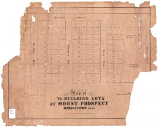
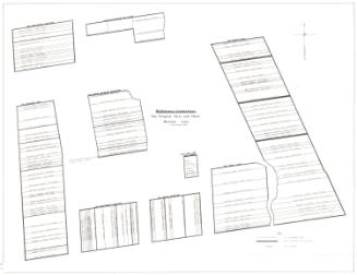
A Plan of the Building Lots to be sold at Auction, on Tuesday, 10th March, by B. Hudson & Company
PrinterPrinted by
D. W. Kellogg & Co.
(American, 1830 - 1840)
Date1830-1840
MediumLithograph; black printer's ink on wove paper
DimensionsPrimary Dimensions (image height x width): 12 3/4 x 21 3/4in. (32.4 x 55.2cm)
Sheet (height x width): 12 3/4 x 21 3/4in. (32.4 x 55.2cm)
ClassificationsGraphics
Credit LineMuseum purchase
Object number1952.98.1
DescriptionMap of 45 numbered lots in Hartford, Connecticut, along Hudson and Buckingham Streets, with park Street to the west and Main Street to the south. Their dimensions, presumably in feet, are printed on the lots. Also on Buckingham Street are four lots owned by Russ, Dellibar, Loomis and the South Church.
Label TextBuckingham Street was an early highway leading west from Main Street. It received its present name in 1827. This 1830s map, which advertises building lots for sale on Hudson Street shows vacant lots on Buckingham Street as well. In contrast to Buckingham Street, Hudson Street was a new street, laid out about this time. Originally just one block long, it would later be extended to both the north and the south.
NotesCartographic Note: no scaleDate Note: Although, according to History of Hartford Streets, Hudson Street was established in 1844, this map was printed by D. W. Kellogg & Co. and the name of that company changed to E.B. & E.C. Kellogg in 1840.
Status
Not on view