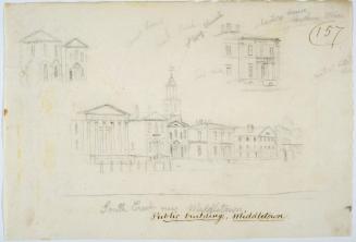
Locations of the First Church of Christ, Hartford, Connecticut
MakerMade by
Jared B. Standish
(American, 1866 - 1961)
DraftsmanDrawn by
Albert L. Washburn
(American, 1857 - 1948)
Dateafter 1896
MediumMimeograph; brown ink on wove paper
DimensionsPrimary Dimensions (image height x width): 12 3/4 x 8in. (32.4 x 20.3cm)
Sheet (height x width): 12 3/4 x 8in. (32.4 x 20.3cm)
Sheet (height x width): 12 3/4 x 8in. (32.4 x 20.3cm)
ClassificationsGraphics
Credit LineGift of Jared B. Standish
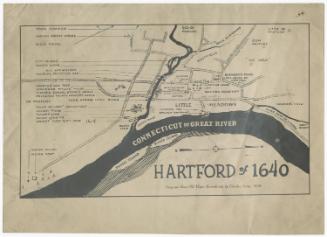
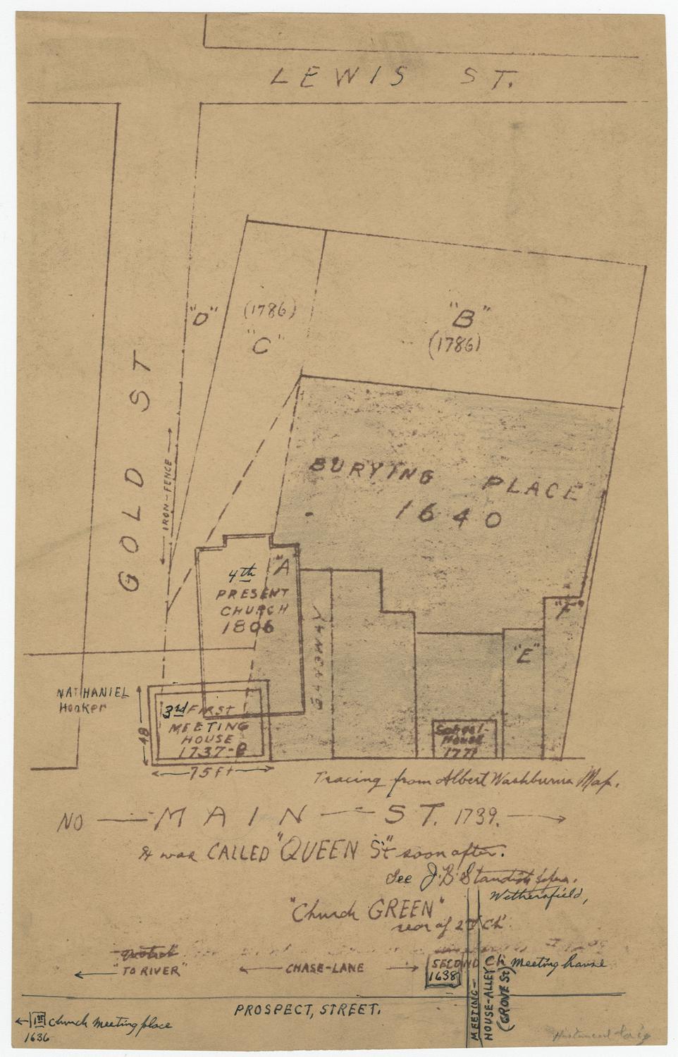
DescriptionCopy of a map made by Albert Washburn, depicting the locations of the First Church of Christ between 1638 and 1806 in Hartford, Connecticut. On Gold Street between Lewis Street and Main Street, diagrams of the church buildings and Ancient Burying Ground are shown. The letters A-F appear on the various parts of the diagrams, with "B" and "C" containing dates but no descriptive information; "A" marking the spot of the church as of 1806; and "D," "E," and "F" not containing any information or dates. The location of the third meeting house, from 1737, is shown at the corner of Gold and Main Streets. The location of a 1771 schoolhouse along Main Street is also depicted. Below this main map is a partially hand-drawn diagram of Prospect Street and what was known as "Meeting-House-Alley" (now Grove Street). At the intersection is the second meeting house, from 1638. The church green is noted as being located behind it. In the bottom left corner is an arrow pointing to the left, indicating the location of the first meeting house, which was established in 1636.
Object number1949.17.0
NotesCartographic Note: No scale
Date Note: The iron fence around Hartford's Ancient Burying Ground was erected in 1896, so this map must have been made after that date.On View
Not on view