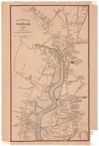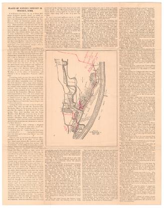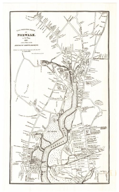
The Principal Parts of Nowalk in the Year 1847 with a Plan of the Ancient Settlement
PublisherPublished by
Friends of Lockwood House, Inc.
(American, founded 1973)
Date1973
MediumLithography; black printer's ink on wove paper
DimensionsPrimary Dimensions (image height x width): 16 1/2 x 9 1/2in. (41.9 x 24.1cm)
Sheet (height x width): 17 7/8 x 10 7/8in. (45.4 x 27.6cm)
Sheet (height x width): 17 7/8 x 10 7/8in. (45.4 x 27.6cm)
ClassificationsGraphics
Credit LineGift of Robert W. Carder
DescriptionReproduction of a map of the town of Norwalk, Connecticut, from the road to New Canaan to the north, Betts' Hill to the east, a salt meadow and marsh to the south, and Prospect Hill to the west. The Norwalk River runs north-south through the town. The land lots of the "ancient settlement," dating to the mid-1600s, are depicted below a dotted line on the right side of the map. The lines of the old lots are shown and they are labeled with the original owner's name and the current owner's name in parentheses (if known). Many of the roads are labeled and are lined with small open squares that represent dwellings, also labeled. Shaded squares represent churches and a town hall. The New York and New Haven Railroad runs east-west through the town. Natural features depicted include salt meadows and marshes, the river, Betts' Hill and Grumman's Hill.
Object number1979.99.1
NotesCartographic Note: No scaleOn View
Not on view