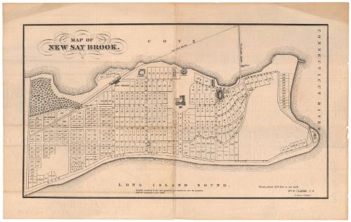
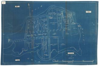
Map of New Say Brook
PrinterPrinted by
Kellogg & Bulkeley
(American, 1867 - 1990)
Dateabout 1870
MediumLithography; black printer's ink on wove paper
DimensionsPrimary Dimensions (image height x width): 8 1/2 x 14 7/8in. (21.6 x 37.8cm)
Sheet (height x width): 10 1/2 x 16 7/8in. (26.7 x 42.9cm)
ClassificationsGraphics
Credit LineGift of the heirs of Morgan B. Brainard
Object number1965.33.32
DescriptionMap of what was referred to as New Say Brook, Connecticut, depicting the lower peninsula of Old Saybrook, with the South Cove to the north, the Connecticut River to the east, and the Long Island Sound to the south. 317 numbered lots of land are depicted, marked with crosses to indicate that they have already been sold, or two lines to indicate that they are withdrawn from sale. Fenwick Hall, a hotel, is depicted in the middle of the peninsula. An unnamed railroad line with a depot and bridge, is shown crossing the peninsula on the left side of the map.
NotesCartographic Note: Scale: 1 inch equals 420 feetStatus
Not on view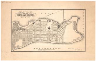


Kellogg & Bulkeley
1915-1920