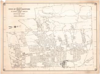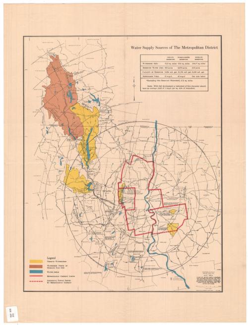
Water Supply Sources of The Metropolitan District
MakerMade by
Metropolitan District Commission
(American, founded 1929)
After a work byAfter a work by
Geological Survey (U.S.)
(American, founded 1879)
Date1946
MediumLithography; black and colored printer's inks on wove paper
DimensionsPrimary Dimensions (image height x width): 16 7/8 x 13 1/8in. (42.9 x 33.3cm)
Sheet (height x width): 21 x 16in. (53.3 x 40.6cm)
ClassificationsGraphics
Credit LineGift of the heirs of Morgan B. Brainard
Object number1965.33.31
DescriptionMap of northwestern and central Connecticut and southwestern Massachusetts. A thick red line indicates the boundaries of the Metropolitan District, within which are Bloomfield, Windsor, West Hartford, Hartford, East Hartford, Wethersfield, Rocky Hill, Glastonbury and Newington. Yellow and brown are used to show the locations of watersheds. Concentric circles in five-mile increments radiate out from the Capitol. The Connecticut River and other water areas are shown in blue. In the top right corner is a table showing the sizes of the Nepaug, Barkhamsted and Hogback reservoirs.
Label TextThe growing need for water in the Hartford area in the first half of the twentieth century caused the Hartford Water Works to greatly expand its water supply system, first by adding more dams and more reservoirs in West Hartford, then reaching out to surrounding towns. The Nepaug Reservoir in Collinsville was begun in 1911 and completed in 1917. By 1931, when the Barkhamsted Reservoir was begun, the Metropolitan District Commission had been created to meet the needs not only of Hartford but of Bloomfield, Newington, Wethersfield, and Windsor as well. This regional approach to water supply made sense, but as the MDC kept adding towns, the demand for water kept increasing. The Barkhamsted Dam was completed in 1940. and planning began almost immediately for yet another reservoir. The Hogback Reservoir appears on this 1946 map, but plans for the new reservoir would not be approved by the General Assembly until 1949, and contruction of the dam would not begin until 1955. It would not be completed until December 7, 1960.
NotesCartographic Note: Scale: 1/4 inch equals 1 mileStatus
Not on view