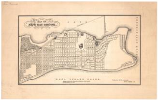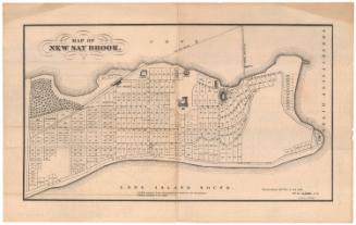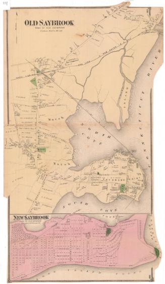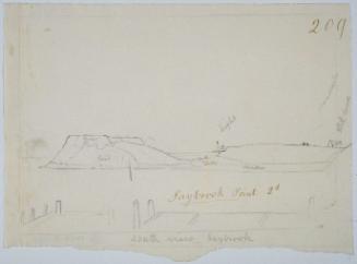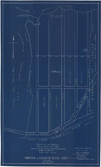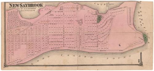
New Saybrook, Town of Old Saybrook
PublisherPublished by
F. W. Beers & Co.
(American)
After a work byAfter a work by
William R. Clarke
(American)
Date1874
MediumLithography; black printer's ink and watercolor on wove paper
DimensionsPrimary Dimensions (image height x width): 6 5/8 x 14 3/4in. (16.8 x 37.5cm)
Sheet (height x width): 7 x 15 1/2in. (17.8 x 39.4cm)
Sheet (height x width): 7 x 15 1/2in. (17.8 x 39.4cm)
ClassificationsGraphics
Credit LineConnecticut Museum of Culture and History collection
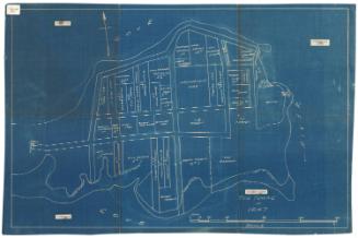
DescriptionMap of what was referred to as "New Saybrook," also known as the Fenwick area of Old Saybrook, Connecticut. The South Cove is to the north, the Connecticut River to the east, and the Long Island Sound is to the south. 317 numbered lots of land are depicted. Fenwick Hall, a hotel, is depicted in the middle of the peninsula. An unnamed railroad line and a depot are shown across the peninsula on the left side of the map. Two areas are colored green, one between Sequassen and Pequot Avenues and the other at the end of the peninsula.
Object number1972.49.0
NotesCartographic Note: Scale: 1 inch equals about 420 feetOn View
Not on view