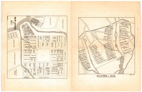
New Haven in 1641
DraftsmanDrawn by
Frederick R. Honey
(American, 1844 - 1929)
Date1880
MediumLithography; black printer's ink on wove paper
DimensionsPrimary Dimensions (New Haven map, image height x width): 8 x 8 3/8in. (20.3 x 21.3cm)
Primary Dimensions (Milford map, image height x width): 7 1/2 x 7 1/2in. (19.1 x 19.1cm)
Sheet (height x width): 18 3/4 x 12in. (47.6 x 30.5cm)
Primary Dimensions (Milford map, image height x width): 7 1/2 x 7 1/2in. (19.1 x 19.1cm)
Sheet (height x width): 18 3/4 x 12in. (47.6 x 30.5cm)
ClassificationsGraphics
Credit LineGift of Yale Univerity
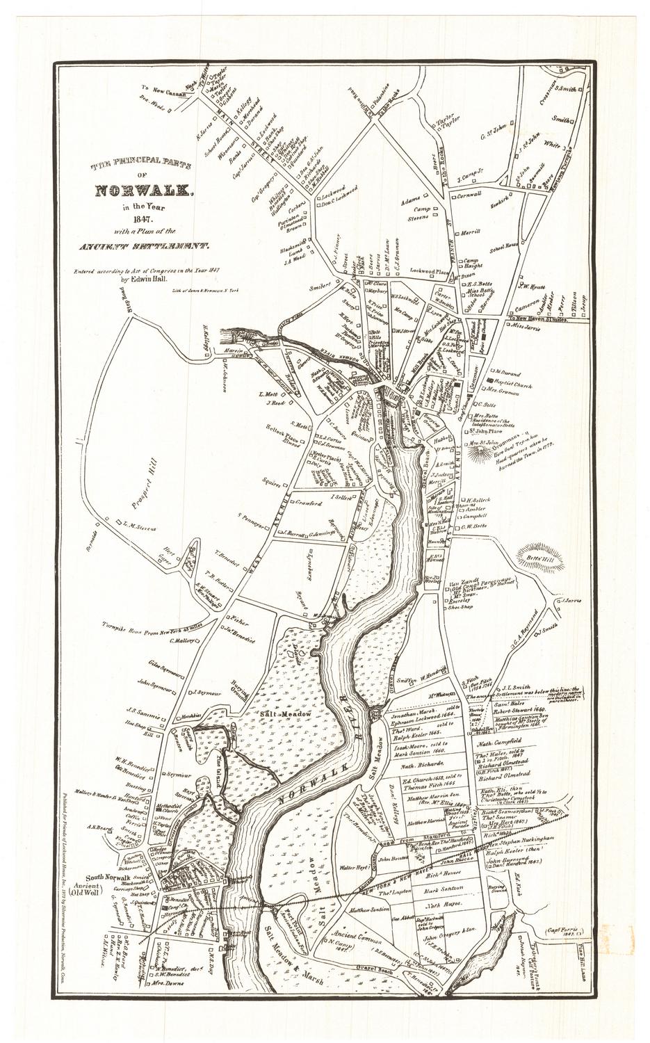
DescriptionTwo maps on the same sheet of paper, one featuring the city center of New Haven, Connecticut, in 1641, and the other depicting Milford, Connecticut, in 1646. The focus of both maps is early property owners: on the New Haven map, the land lots are depicted, divided with solid black lines and labeled with the owner's name; on the Milford map, land lots are not shown but landholders' names are. Bodies of water are shown but not labeled.
Object number1912.5.0
NotesCartographic Note: No scaleOn View
Not on view
Silvermine Production
1973