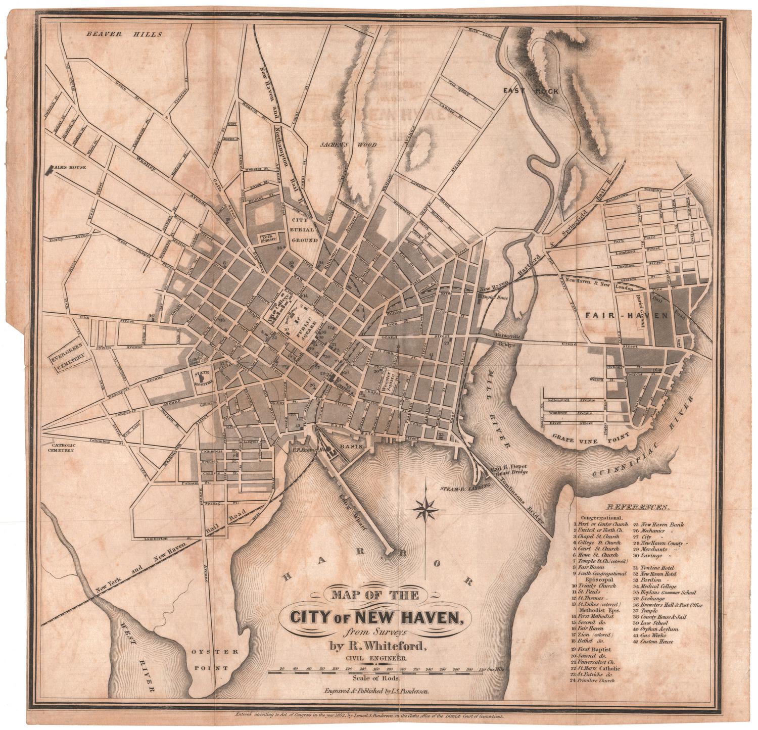
Map of the City of New Haven from Surveys
SurveyorSurveyed by
R. Whiteford
(American)
PrintmakerEngraved by
Lemuel S. Punderson
(American, 1824 - 1910)
PrinterPrinted by
Lemuel S. Punderson
(American, 1824 - 1910)
PublisherPublished by
Lemuel S. Punderson
(American, 1824 - 1910)
Date1852
MediumEngraving; black printer's ink on wove paper
DimensionsPrimary Dimensions (image height x width): 12 7/8 x 12 3/4in. (32.7 x 32.4cm)
Sheet (height x width): 13 1/4 x 13 3/4in. (33.7 x 34.9cm)
ClassificationsGraphics
Credit LineMuseum purchase
Object number1951.35.0
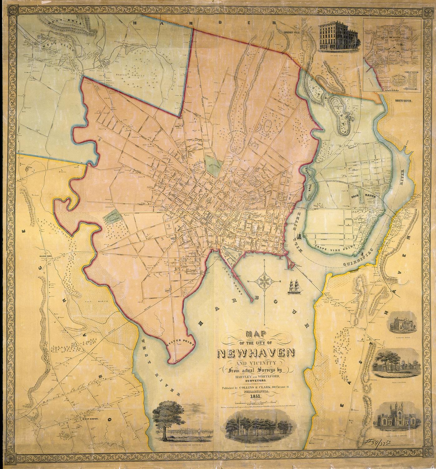
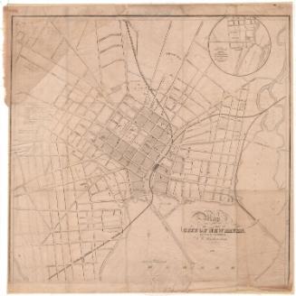
DescriptionMap of the city of New Haven, Connecticut, from Beaver Hills and East Rock to the north, Fairhaven to the east, the New Haven Harbor to the south, and Evergreen Cemetery to the west. The streets are labeled and churches, banks, hotels and public buildings are represented by black rectangles. The buildings are numbered and named in the corresponding references list. Also shown are the city burial ground, York Square, Yale College, the State House, State Hospital, Alms House, Public Square and Wooster Square. Sachem's Wood is located to the north of the city. Between New Haven and Fairhaven are the Mill River and the Quinnipiac River; in the bottom left corner of the map, the West River is shown. The New York and New Haven Railroad; the New Haven and Northampton; the New Haven, Hartford and Springfield Railroad; and the New Haven and New London Railroad all run through the city. Elevation is conveyed through hachure marks.
Label TextThe vertical and horizontal folds in this small map suggest that it was probably originally issued either as a folding plate in a city directory or as a separate "pocket map." Pocket maps were sold individually; each map was folded into its own cardboard covers, somewhat like modern road maps. Like modern road maps, these maps were used by individuals to help them find their way--in this case, around the cityof New Haven. The maps had to be unfolded for consultation, then folded back into their protective covers, causing wear and tears along the fold lines. Because they tended to wear out, relatively few examples of these once numerous maps survive in good condition.
NotesCartographic Note: Scale: About 1/4 inch equals 20 rodsStatus
Not on view