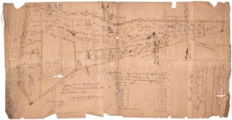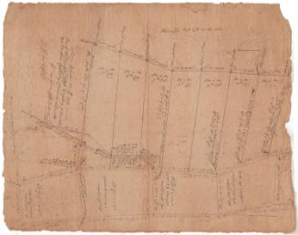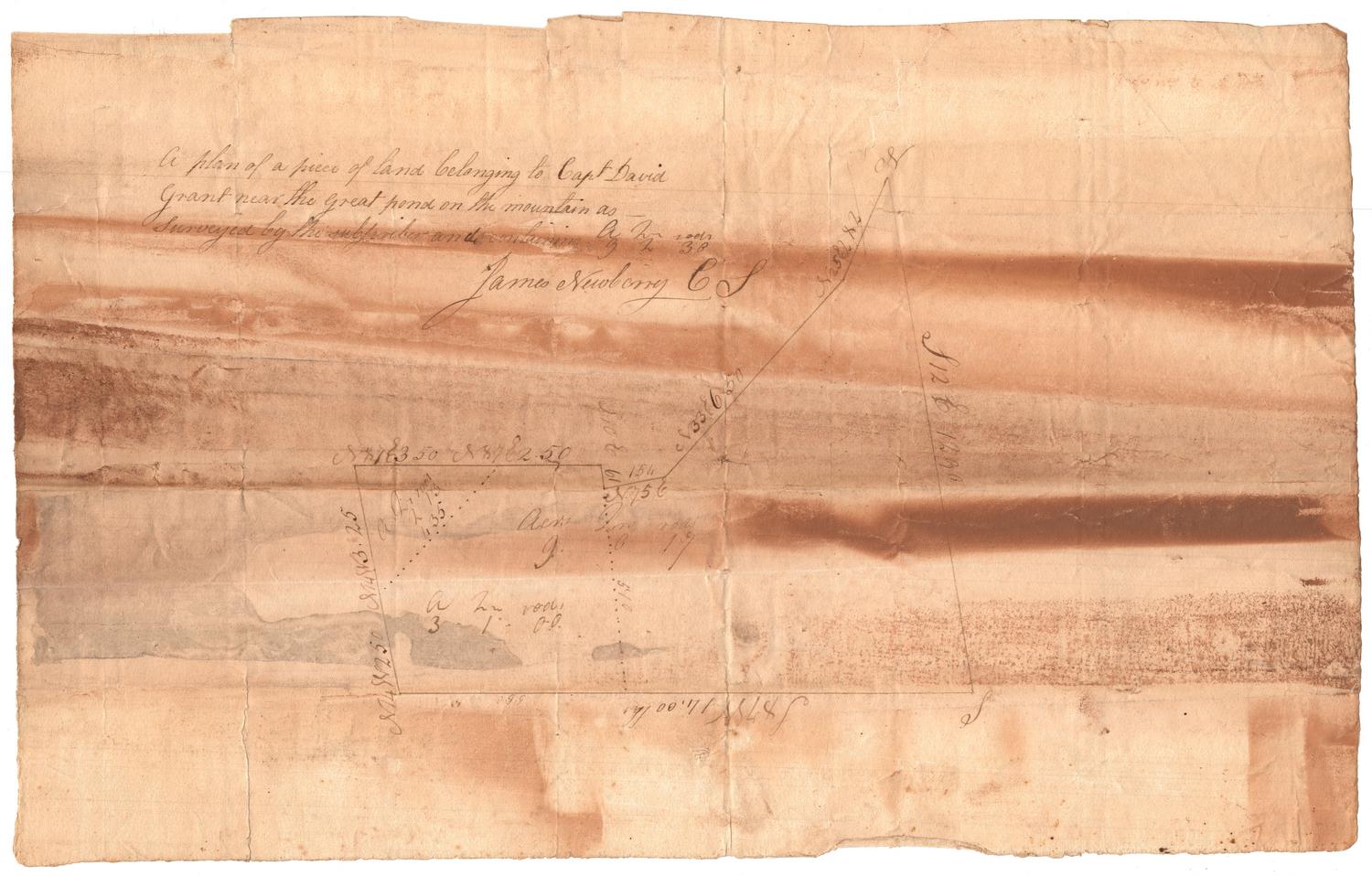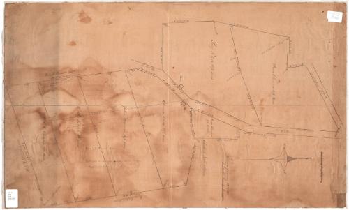
Surveyed land in Litchfield
SurveyorSurveyed by
Truman Guild
(American, 1806 - 1890)
DraftsmanDrawn by
Truman Guild
(American, 1806 - 1890)
Date1846
MediumDrawing; black ink on paper, lined with linen
DimensionsPrimary Dimensions (image height x width): 27 3/4 x 17in. (70.5 x 43.2cm)
Sheet (height x width): 27 3/4 x 17in. (70.5 x 43.2cm)
Mount (height x width): 27 3/4 x 17in. (70.5 x 43.2cm)
ClassificationsGraphics
Credit LineConnecticut Museum of Culture and History collection
Object number2006.128.0
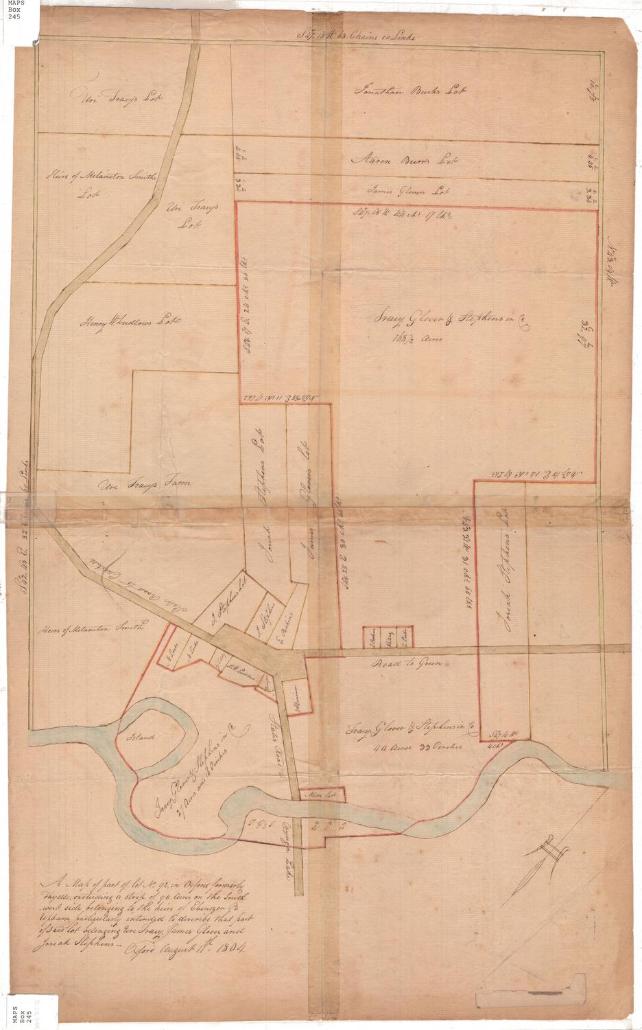
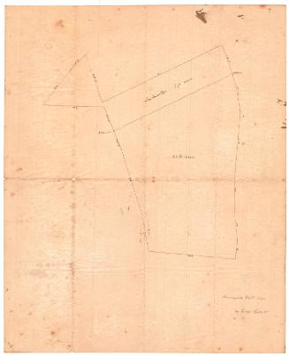
DescriptionSurvey of the lots of land along a highway in Litchfield. The lots are labeled with the owner's name; the degrees, minutes and seconds of each boundary line; and the area in acres. Buildings, such as houses or barns, are noted, as are the locations of stones, springs and walls. Dotted lines indicate the locations of stone walls.
Label TextMany of the owners of property shown on this 1846 map are women, and some of them are closely related. Abel H. Clemons was the father of Anna Clemons. Another daughter, Lucy, married John T. Peters. Peters died in 1878 and notations added after that date show property that formerly belonged to Julia Stoaddard and Dotha Patrick as part of his estate. A portion of this property is identified Peters's "Widow's Dower." Lucy Peters died in Hartford on February 21, 1885.
NotesCartographic Note: No scaleStatus
Not on view


2022 July 8