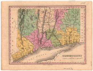
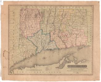
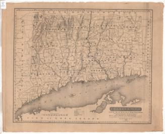
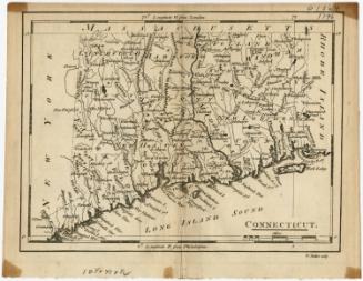
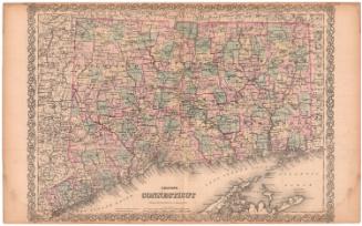
The Plan of the Colony of Connecticut in North America
DraftsmanDrawn by
Moses Park
(American, 1733 - 1807)
Date1766
MediumEngraving; black printer's ink on laid paper, lined with paper
DimensionsPrimary Dimensions (image height x width): 21 1/8 x 29 1/4in. (53.7 x 74.3cm)
Sheet (height x width): 21 5/8 x 29 3/4in. (54.9 x 75.6cm)
ClassificationsGraphics
Credit LineConnecticut Museum of Culture and History collection
Object number1991.191.0
DescriptionMap of Connecticut, with the north shore of Long Island and the Long Island Sound to the south. The state is divided into six counties (Litchfield, Hartford, Windham, Fairfield, New Haven and New London), outlined and filled in with watercolor. Towns are denoted with solid black lines, and population centers with a single building. Lighthouses are shown, as are roads, delineated with two parallel broken solid lines. Natural features include elevation, conveyed with clusters of peaks, rivers, reefs, islands and harbors.
Label TextMoses Park's Plan of the Colony of Connecticut, with its elegant dedication to "The Right Honourable the Earl of Shelburne," was produced in 1766, the year after the Stamp Act aroused the first serious oppostion to British rule among the American colonists. The British government had requested a map from the Connecticut General Assembly in 1765, as part of an effort to improve mail service. The map was executed by Moses Park, a lifelong resident of Preston, Connecticut, and sold by John Durkee in Norwich, Edward Mott in Preston, and at the Printing Office in New London, perhaps an indication that the map was printed there. Park's map depicts the colony on the brink of revolution. Park reveals his Connecticut bias by showing the towns of Suffield, Enfield, and Somers as part of that colony at a time when they were still being claimed by the neighboring colony of Massachusetts.
NotesCartographic Note: Scale: 1/4 inch equals 1 mile. Longitude is given as 55.24 degrees west of London. This error of approximately twenty degrees would place Connecticut in the middle of the Atlantic Ocean.Status
Not on view