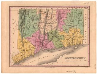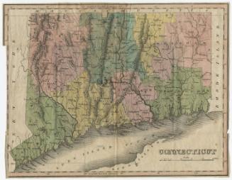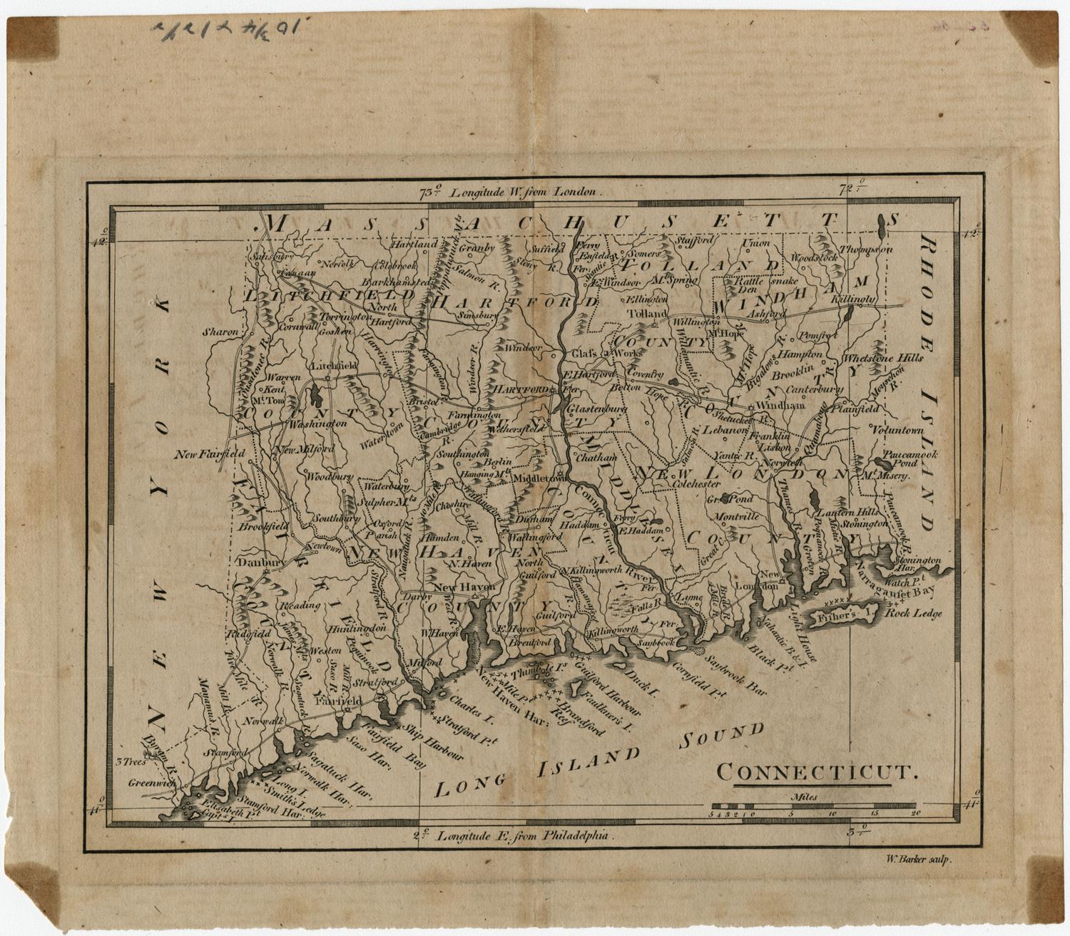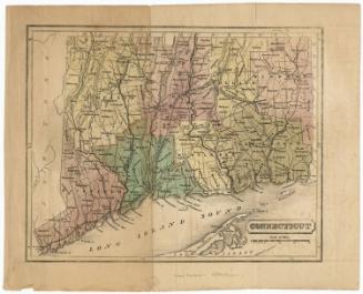
The Plan of the Colony of Connecticut in North America
DraftsmanDrawn by
Moses Park
(American, 1733 - 1807)
Date1766
MediumEngraving; black printer's ink on laid paper, lined with paper
DimensionsPrimary Dimensions (image height x width): 21 1/8 x 29 1/4in. (53.7 x 74.3cm)
Sheet (height x width): 21 5/8 x 29 3/4in. (54.9 x 75.6cm)
Sheet (height x width): 21 5/8 x 29 3/4in. (54.9 x 75.6cm)
ClassificationsGraphics
Credit LineConnecticut Museum of Culture and History collection
DescriptionMap of Connecticut, with the north shore of Long Island and the Long Island Sound to the south. The state is divided into six counties (Litchfield, Hartford, Windham, Fairfield, New Haven and New London), outlined and filled in with watercolor. Towns are denoted with solid black lines, and population centers with a single building. Lighthouses are shown, as are roads, delineated with two parallel broken solid lines. Natural features include elevation, conveyed with clusters of peaks, rivers, reefs, islands and harbors.
Object number1991.191.0
NotesCartographic Note: Scale: 1/4 inch equals 1 mile. Longitude is given as 55.24 degrees west of London. This error of approximately twenty degrees would place Connecticut in the middle of the Atlantic Ocean.On View
Not on view