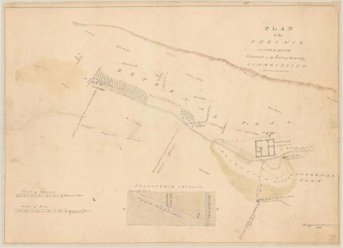
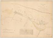
Plan of the Pheonix Copper Mine
SurveyorSurveyed by
Westgarth Forster
(British, 1772 - 1835)
DraftsmanDrawn by
Westgarth Forster
(British, 1772 - 1835)
Date1830
MediumDrawing; black ink and watercolor on paper, lined with paper
DimensionsPrimary Dimensions (image height x width): 20 7/8 x 29 1/2in. (53 x 74.9cm)
Sheet (height x width): 21 1/2 x 29 3/4in. (54.6 x 75.6cm)
Mount (height x width): 21 3/4 x 29 3/4in. (55.2 x 75.6cm)
Sheet (height x width): 21 1/2 x 29 3/4in. (54.6 x 75.6cm)
Mount (height x width): 21 3/4 x 29 3/4in. (55.2 x 75.6cm)
ClassificationsGraphics
Credit LineGift of C. Russell Noyes
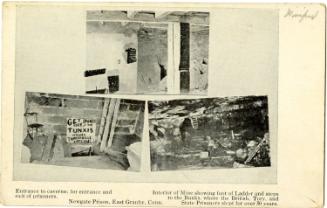
DescriptionMap of the Phoenix Copper Mine in Granby, Connecticut, showing an external plan, internal plan and transverse section. The external plan is divided into three sections, with the boundary for each one marked with a tree along a line of stakes and stone. The distance between each section is shown in chains and links. At the bottom of the third section on the left is a paling, North Hill and an old shaft; at the bottom of the second section is another old shaft; and at the bottom of the first section is Newgate Prison, Veits' Inn (Viets Inn, most likely), and a third old shaft. Right below, the internal plan shows the location of the mine shaft and well, and gives its depth at 57 feet. The way gate or ladder shaft is located below and to the left of the mine shaft. At the bottom of the sheet is a transverse section of the plan showing the vein, way gate and shaft, and the well shaft.
Object number1952.97.2
NotesCartographic note: Scale, external plan, in chains: 1 inch equals 3 chains. Scale, internal plan and transverse section, in feet: 1/2 inch equals 10 feetOn View
Not on view
ca. 1950

David Goodell