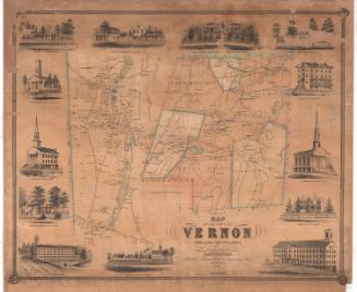
Rockville:Vernon
SurveyorSurveyed by
Ormando Willis Gray
(American, born 1829)
PrinterPrinted by
Kellogg & Bulkeley
(American, 1867 - 1990)
PublisherPublished by
C. G. Keeney
(American, about 1810 - 1888)
Date1869
MediumLithography; printer's ink and watercolor on wove paper
DimensionsPrimary Dimensions (image height x width): 16 1/4 x 27 1/2in. (41.3 x 69.9cm)
Sheet (height x width): 18 1/4 x 28 1/4in. (46.4 x 71.8cm)
ClassificationsGraphics
Credit LineConnecticut Museum of Culture and History collection
Object number2006.124.0
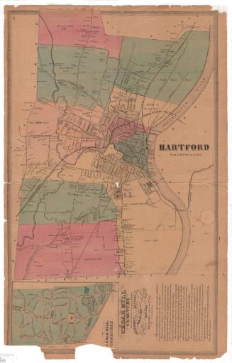
DescriptionMap of the manufacturing community of Rockville in the town of Vernon, Connecticut. Industrial development is concentrated in the West and East Districts, along the Rockville Railroad and the Hockanum River. Factories include Belding Brothers, Florence Mills, the Glasgow Thread Company, the New England Company, Rock Manufacturing Company, Springville Manufacturing, and White Corbin and Company. The Grove Hill Cemetery, the Catholic Cemetery, and Hyde Park appear in the Northeast District. A business directory lists attorneys, banks, a dentist, a hotel, an insurance agency, merchants, manufacturers, physicians, tailors, and miscellaneous businesses.
Label TextRockville in 1869 had not yet been incorporated as a city, but already it overshadowed the town of Vernon, of which it was (and remains) a part. It was already the site of numerous textile mills that manufactured woolen and cotton cloth and thread. The presence of a large Catholic cemetery suggests that it had already received a large influx of foreign workers as well. This map was part of an atlas of Windham and Tolland Counties printed and published in Hartford in 1869.
NotesCartographic Note: One inch equals thirty milesSubject Note: The Tolland Agricultural Society held its annual fair at Hyde Park.
Status
Not on view


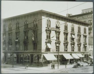
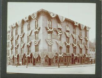
J. C. Dexter Photo Company
1908