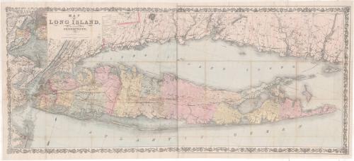
Map of Long Island, and the Southern Part of Connecticut
PublisherPublished by
G.W. & C.B. Colton & Co.
(American, founded 1865)
Date1866
MediumLithography; black printer's ink and watercolor on paper, lined with paper
DimensionsPrimary Dimensions (image height x width): 22 1/4 x 51 5/16in. (56.5 x 130.3cm)
Sheet (height x width): 23 3/4 x 52 3/8in. (60.3 x 133cm)
Mount (height x width): 23 3/4 x 52 3/8in. (60.3 x 133cm)
Sheet (height x width): 23 3/4 x 52 3/8in. (60.3 x 133cm)
Mount (height x width): 23 3/4 x 52 3/8in. (60.3 x 133cm)
ClassificationsGraphics
Credit LineThe Newman S. Hungerford Museum Fund
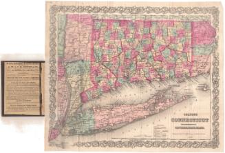
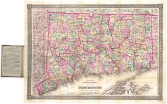
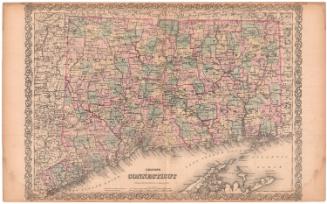
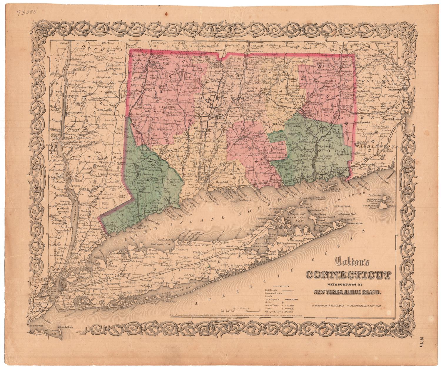
DescriptionMap of Long Island, New York, and southern Connecticut, emphasizing the counties and towns on Long Island. County seats, villages with post offices, and villages are the populated areas shown. City streets are depicted in Manhattan; Brooklyn; New Haven; and Lakeland and Hermanville, Long Island. Churches and meeting houses are represented with symbols. Railroads depicted include the Long Island, Harlem, and New York and New Haven Railroads. Projected railroads are also shown. Other kinds of transportation infrastructure depicted include turnpike roads, post roads and canals. Mills and factories are also pictured, mostly along rivers. In the top left corner is an inset map of the New York Harbor and Bay, with water depth noted. Natural features depicted include elevation, conveyed through hachure marks; forests; and swampland.
Object number2013.46.0
NotesCartographic Note: Scale: About 3/8 inches equals 1 mileOn View
Not on view