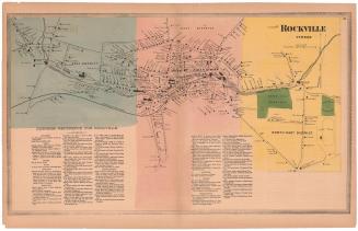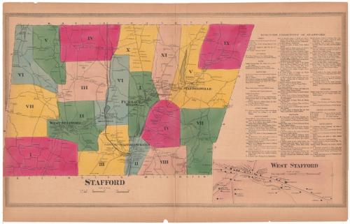
Stafford
SurveyorSurveyed by
Ormando Willis Gray
(American, born 1829)
PrinterPrinted by
Kellogg & Bulkeley
(American, 1867 - 1990)
PublisherPublished by
C. G. Keeney
(American, about 1810 - 1888)
Date1869
MediumLithography; black printer's ink and watercolor on wove paper
DimensionsPrimary Dimensions (image height x width): 16 1/8 x 28 1/4in. (41 x 71.8cm)
Sheet (height x width): 18 1/4 x 28 3/8in. (46.4 x 72.1cm)
ClassificationsGraphics
Credit LineConnecticut Museum of Culture and History collection
Object number2006.122.0
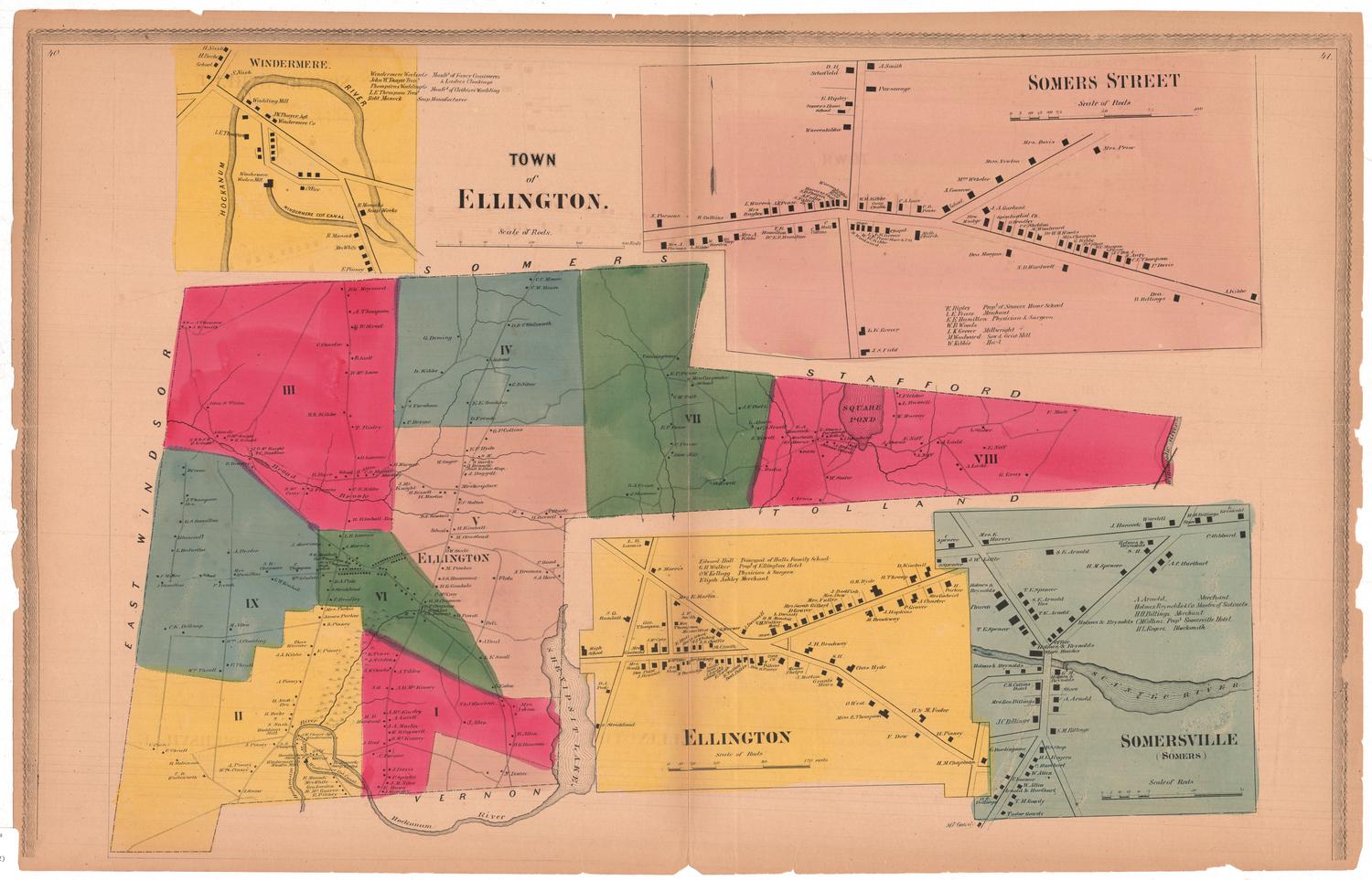
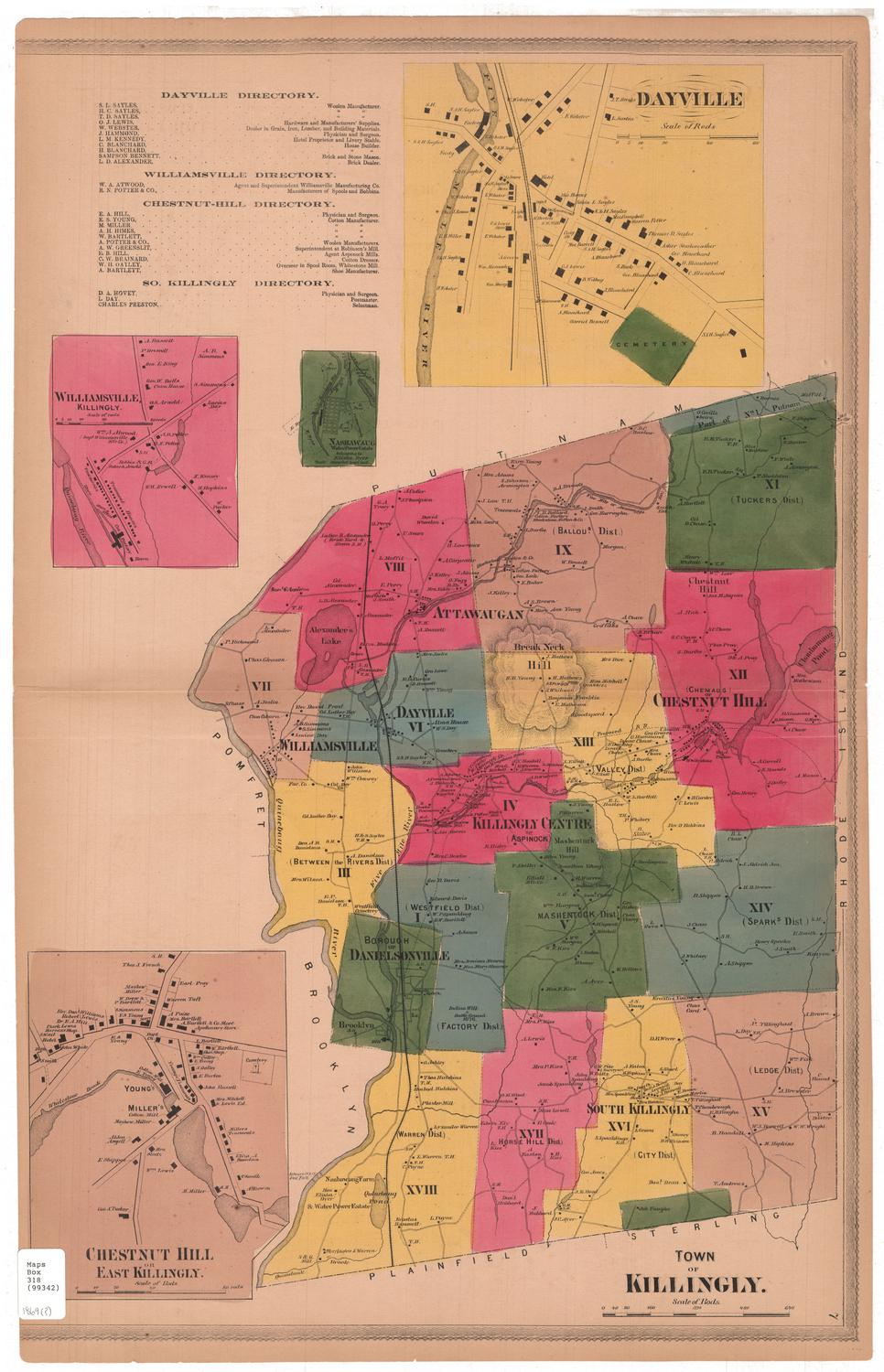
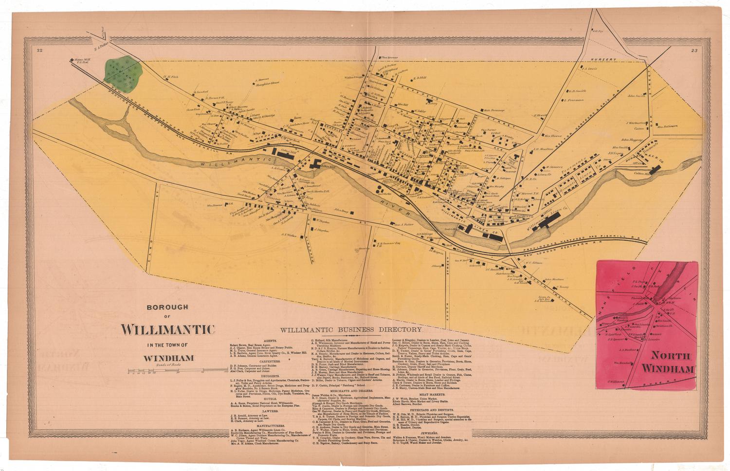
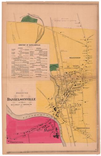
DescriptionMap of the town of Stafford, Connecticut, divided into eleven numbered districts, colored and divided by broken solid lines. Roads are shown but are not labeled. Small squares denote the locations of buildings, which are labeled with the names of property owners. The New London Norther Railroad runs north-south through the town. To the right is a business directory of Stafford, below which is an inset map of West Stafford.
Label TextIn the late eighteenth and early nineteenth centuries, Stafford, Connecticut was known for its mineral springs and famed as a health resort. The town also had a long industrial past; during the American Revolution, cannon and cannon shot for the Contintental Army were made in a blast furnace in Furnace Hollow. During the nineteenth century, textile mills flourished along the Willimantic River and its tributaries, while other parts of the town remained sparsely settled and decidedly rural. This map was part of an atlas of Windham and Tolland Counties printed and published in Hartford in 1869.
NotesCartographic Note: Scale, Stafford: about 1/2 inch equals 80 rods; West Stafford: about 1/2 inch equals 25 rodsStatus
Not on view