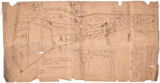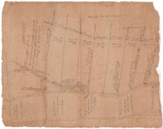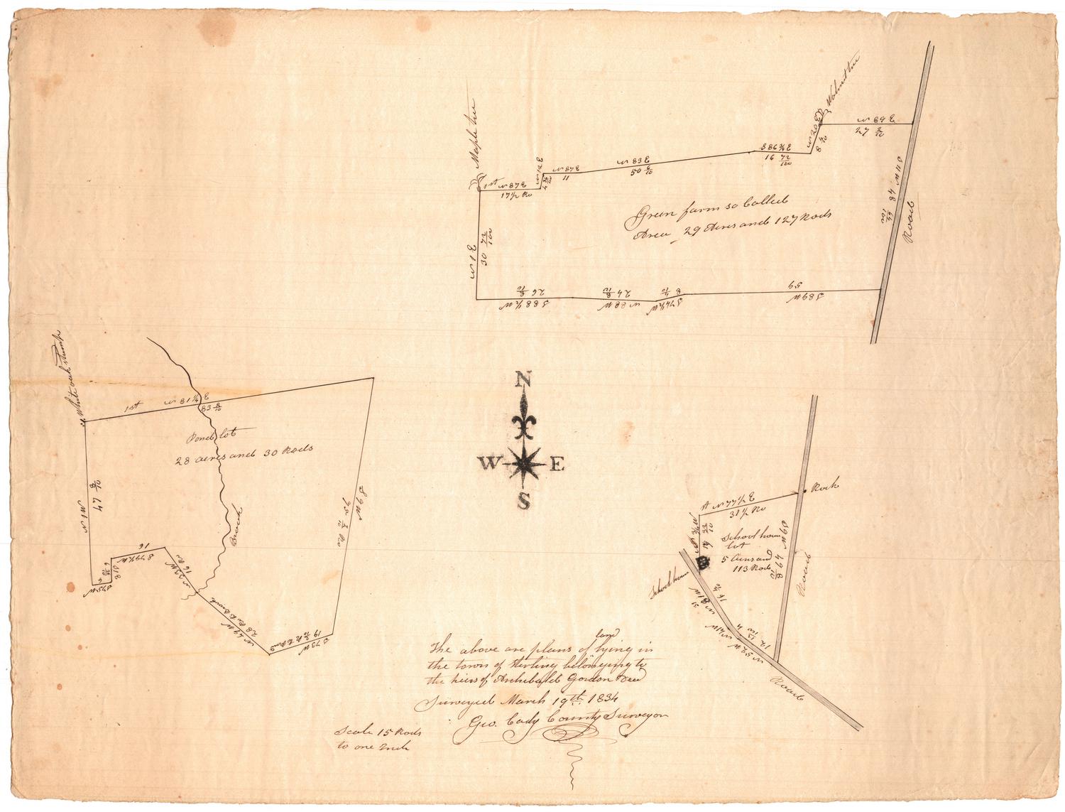
The above are plans of land lying in the town of Sterling belonging to the heirs of Archibald Gordon
SurveyorSurveyed by
George Cady
(American, 1795 - 1865)
Date1834
MediumDrawing; black ink on wove paper
DimensionsPrimary Dimensions (image height x width): 15 3/8 x 20 1/4in. (39.1 x 51.4cm)
Sheet (height x width): 15 3/8 x 20 1/4in. (39.1 x 51.4cm)
Sheet (height x width): 15 3/8 x 20 1/4in. (39.1 x 51.4cm)
ClassificationsGraphics
Credit LineMuseum purchase
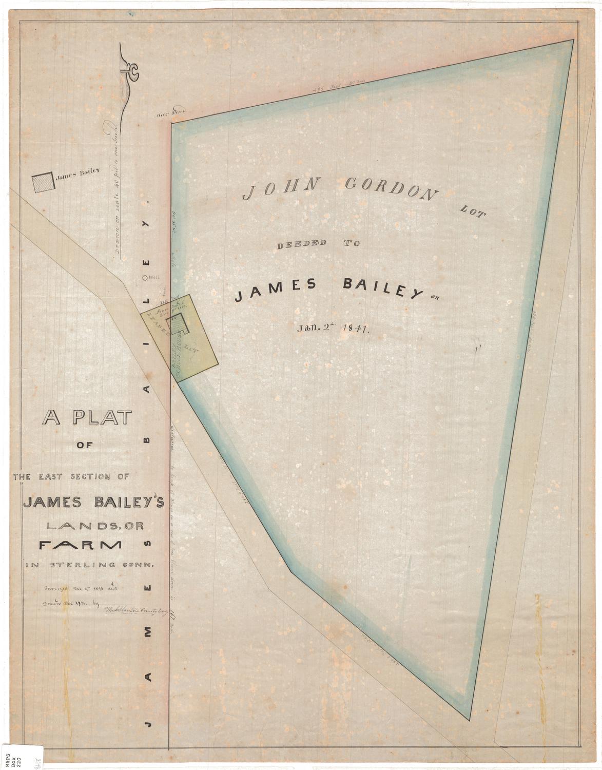
DescriptionThree plat maps on one sheet of paper, depicting a farm lot, a schoolhouse lot and a pond lot. Geographic coordinates are given, as are dimensions in feet (presumably) and area in acres and rods. The only building depicted is the school house.
Object number1969.42.4
NotesCartographic Note: Scale: 1 inch equals 15 rodsOn View
Not on view
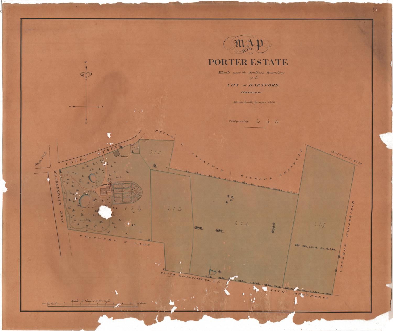
William C. Stanton
1848