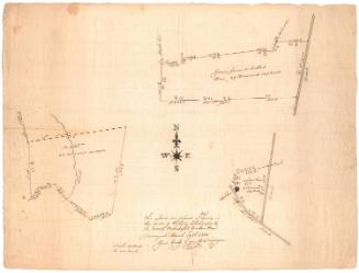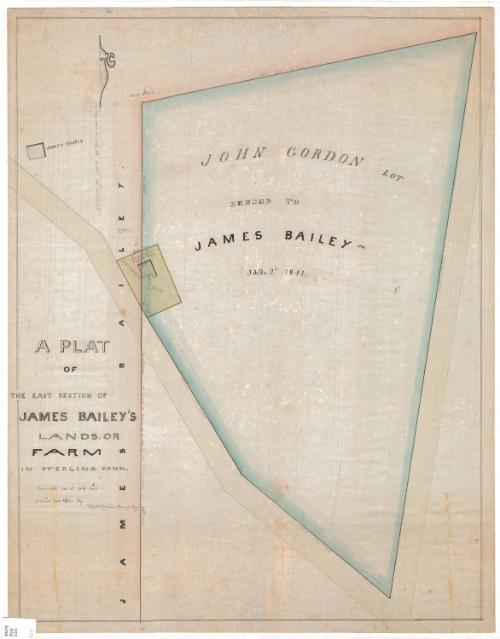
A Plat of the East Section ofJoseph Bailey's Lands, or Farm in Sterling, Connecticut
SurveyorSurveyed by
William C. Stanton
(American, 1807 - 1877)
DraftsmanDrawn by
William C. Stanton
(American, 1807 - 1877)
Date1848
MediumDrawing; watercolor on wove paper
DimensionsPrimary Dimensions (image height x width): 21 3/4 x 16 3/4in. (55.2 x 42.5cm)
Sheet (height x width): 22 1/2 x 17 5/8in. (57.2 x 44.8cm)
Sheet (height x width): 22 1/2 x 17 5/8in. (57.2 x 44.8cm)
ClassificationsGraphics
Credit LineMuseum purchase
DescriptionPlat map of a land lot in Sterling, Connecticut, belonging to James Bailey. The land is located at the corner of two unnamed roads and is measured in feet and rods. Along the left side is a leased lot that is partly inside the Bailey lot and partly outside; on it stands the Bailey Schoolhouse. Another building, labeled "James Bailey," appears at the top left.
Object number1969.42.3
NotesCartographic Note: Scale: 1 inch equals 40 feetOn View
Not on view