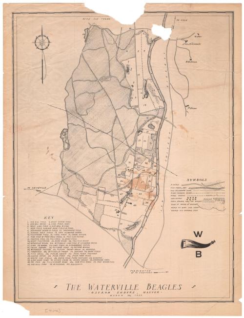
The Waterville Beagles
DraftsmanDrawn by
Unknown
Date1939
MediumLithography; black printer's ink on wove paper
DimensionsPrimary Dimensions (image height x width): 17 x 12 15/16in. (43.2 x 32.9cm)
Sheet (height x width): 18 1/4 x 14in. (46.4 x 35.6cm)
Sheet (height x width): 18 1/4 x 14in. (46.4 x 35.6cm)
ClassificationsGraphics
Credit LineGift of Ethel Davis
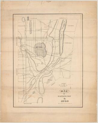
DescriptionMap of a portion of Avon, Connecticut, with farmland to the north, the Farmington River to the east, the road to Unionville to the south, and Pine Woods Pond to the west. The map details the land features, using different lines to denote woods, marshes, orchards, brush, and ponds, with fields appearing as blank spots. Lines representing wire fences separate the various parcels of land. Roads are shown as two parallel lines, and a dry canal bed is also depicted. Most of the land is numbered on the map and labeled in a list in the lower left corner.
Object number2006.121.0
NotesCartographic Note: Scale: 1 inch equals 600 feetOn View
Not on view

Silvermine Production
1973