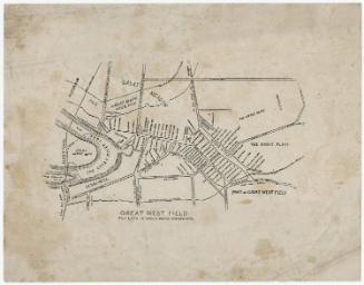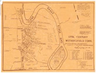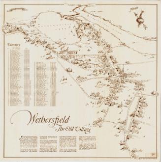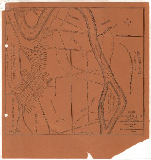
Village of Wethersfield, Connecticut, A.D. 1634 to 1644, Showing the House Lots of the Original Settlers
DraftsmanDrawn by
Sherman Wolcott Adams
(American, 1836 - 1898)
Date1885
MediumLithography; black printer's ink on wove paper
DimensionsPrimary Dimensions (image height x width): 10 1/8 x 11 1/8in. (25.7 x 28.3cm)
Sheet (height x width): 12 1/2 x 11 1/2in. (31.8 x 29.2cm)
Sheet (height x width): 12 1/2 x 11 1/2in. (31.8 x 29.2cm)
ClassificationsGraphics
Credit LineConnecticut Museum of Culture and History collection
DescriptionMap of Wethersfield, Connecticut, with the Connecticut River to the north, Naubuck Farms to the east, the Great Plain to the south, and the Great West Field to the west. The streets shown are labeled, and in the village center between Fort Street and Broad Street, the original settlers' house lots are denoted with small black squares and the owner's names. The late-nineteenth century course of the Connecticut River is shown in broken solid lines.
Object number2005.188.0
NotesCartographic Note: 1 inch equals 40 rodsOn View
Not on view