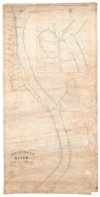
Wethersfield: The Old Village
MakerMade by
Philip Lohman
(American, born 1939)
PublisherPublished by
The Wethersfield Historical Society
(American)
Date1974
MediumLithography; brown printer's ink on wove paper
DimensionsPrimary Dimensions (image height x width): 30 x 30 1/4in. (76.2 x 76.8cm)
Sheet (height x width): 31 x 31in. (78.7 x 78.7cm)
Sheet (height x width): 31 x 31in. (78.7 x 78.7cm)
ClassificationsGraphics
Credit LineMuseum purchase
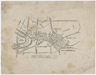
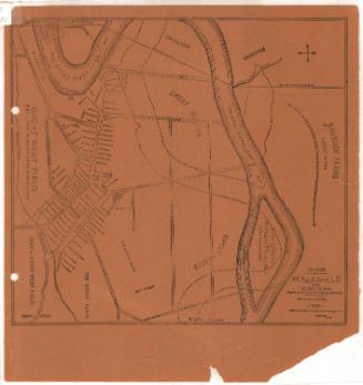
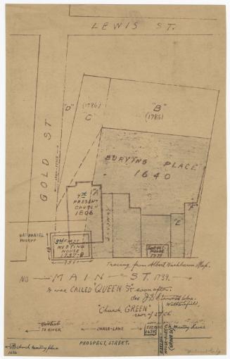
DescriptionMap of the village of Wethersfield, Connecticut, depicting the mid-twentieth century appearance of the village, with the buildings and street system as they looked pre-1840. 116 buildings are shown and numbered, with each number corresponding to a list containing information about the original owner, date of construction, and the street on which the building was located. Natural features include the Wethersfield Cove and the Connecticut River, both depicted at the top. At the bottom is historical information about Wethersfield and descriptive information about the map.
Object number1981.144.1
NotesCartographic Note: No scaleOn View
Not on view