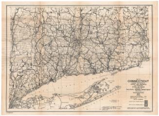
Map Showing Route Numbers Placed on Poles for Directing Traffic
PublisherPublished by
Connecticut State Highway Department
(American, 1895 - 1969)
Date1923
MediumLithography; black printer's ink on wove paper
DimensionsPrimary Dimensions (image height x width): 17 3/8 x 23 1/4in. (44.1 x 59.1cm)
Sheet (height x width): 18 1/2 x 24 1/8in. (47 x 61.3cm)
ClassificationsGraphics
Credit LineConnecticut Museum of Culture and History collection
Object number2005.187.0
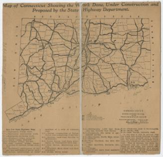
DescriptionMap of the state of Connecticut, from Massachusetts to the north, Rhode Island to the east, the Long Island Sound to the south, and New York State to the west. Improved are shown in thick solid lines, unimproved roads in thin parallel black lines, and unimproved secondary roads in thin solid lines. Those with route numbers are numbered on the map. Towns are labeled, and cities are marked with closed or open circles, presumably depending on their population size.
Label TextAs motorists took to the road in ever increasing numbers, better signage was needed to help them find their way. Route numbers were first introduced in 1922 and were indicated in black on yellow bands painted around utility poles along the roadsides. This numbering system was abandonned in 1932, when nearly all of the state highways received new numbers, the numbers that they still bear today.
NotesCartographic Note: Scale: About 1/4 inch equals 1 mileStatus
Not on view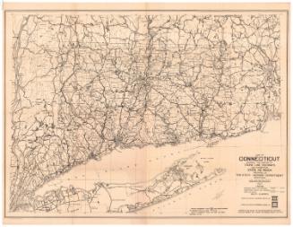
Connecticut State Highway Department
1927
Connecticut State Highway Department
1930
Connecticut State Highway Department
1934
Connecticut State Highway Department
1925
Connecticut State Highway Department
1916