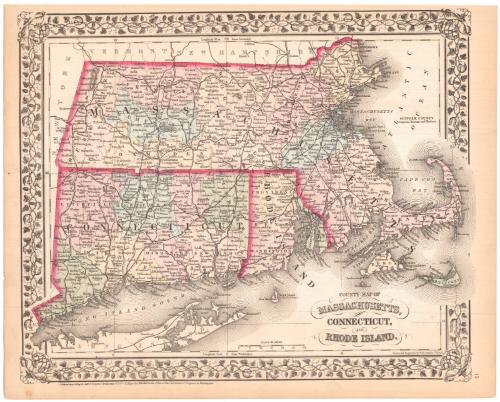
County Map of Massachusetts, Connecticut and Rhode Island
DraftsmanDrawn by
William Henry Gamble
(American, active 1867 - 1887)
PrintmakerEngraved by
William Henry Gamble
(American, active 1867 - 1887)
PublisherPublished by
Samuel Augustus Mitchell
(1792 - 1868)
Date1872
MediumLithography; printer's ink and watercolor on wove paper
DimensionsPrimary Dimensions (image height x width): 11 3/8 x 13 7/8in. (28.9 x 35.2cm)
Sheet (height x width): 12 1/8 x 15 1/8in. (30.8 x 38.4cm)
ClassificationsGraphics
Credit LineMuseum purchase
Object number1979.96.5
DescriptionMap of Massachusetts, Connecticut, and Rhode Island, with New York to the west, Vermont and New Hampshire to the north, the Atlantic Ocean to the east, and Long Island Sound and part of Long Island to the south. Town lines are not indicated, but county lines and railroads are shown; some railroad stations and villages as well as towns and cities are identified. The map is surrounded by a decorative border with a grapevine design. Cape Cod and Natucket extend beyond the right border; Fairfield County extends into the left border.
Label TextSamuel Augustus Mitchell was born in Bristol, Connecticutin 1792. After teaching for a few years and finding the geography textbooks inadequate, he moved to Philadelphia, Pennsylvania and became a map publisher. He is well-known as a publisher of maps for educational purposes, but he also produced atlases for general use. This 1872 County Map of Massachusetts, Connecticut and Rhode Island is a page from such an atlas. Although the signature states that it was "Engraved by W. H. Gamble," the map is actually a transfer lithograph. Gamble's engraving was transferred to a lithographic stone, which was then used to print the maps more quickly and efficiently than would have been possible using the original copper plate.
NotesCartographic Note: 2 inches = 30 milesStatus
Not on view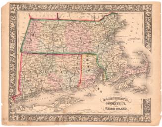


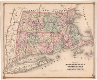

H. F. Sumner & Co.
1833


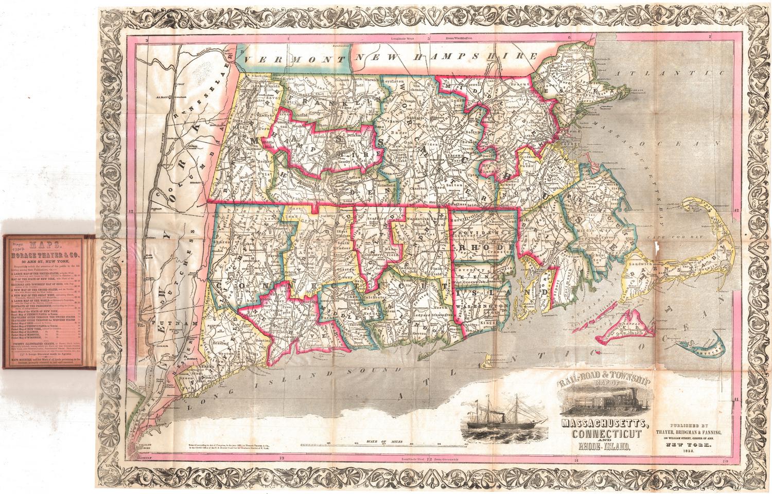
Thayer, Bridgman & Fanning
1853
