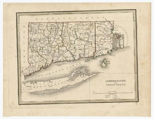
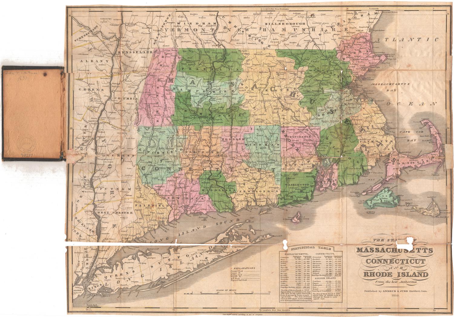
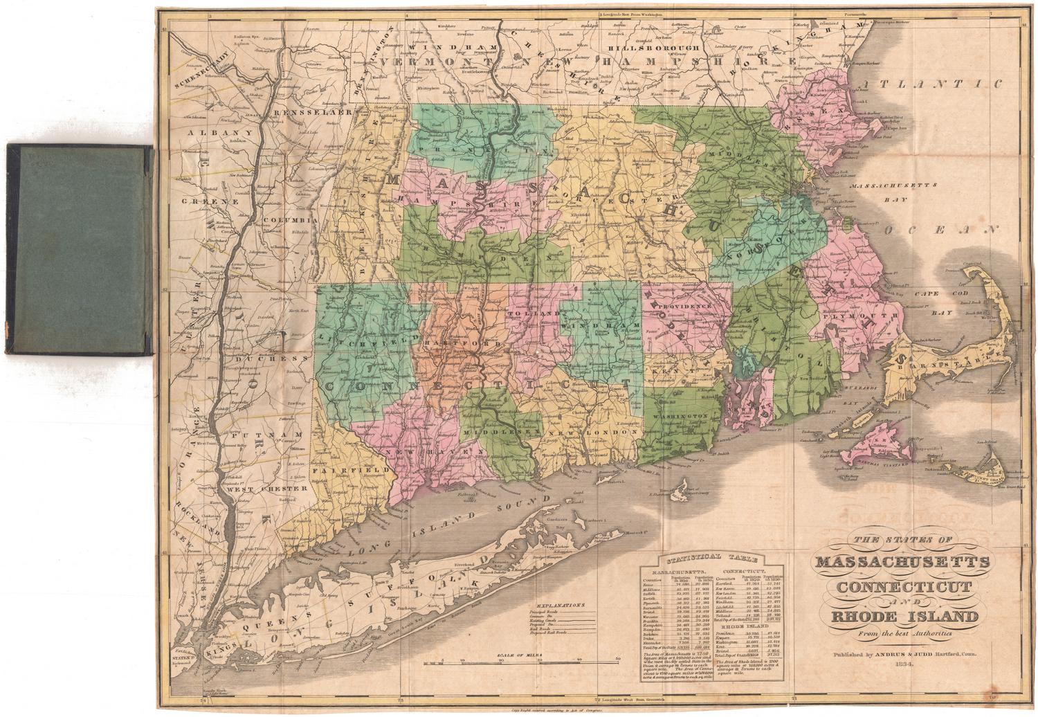
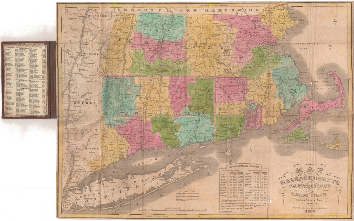
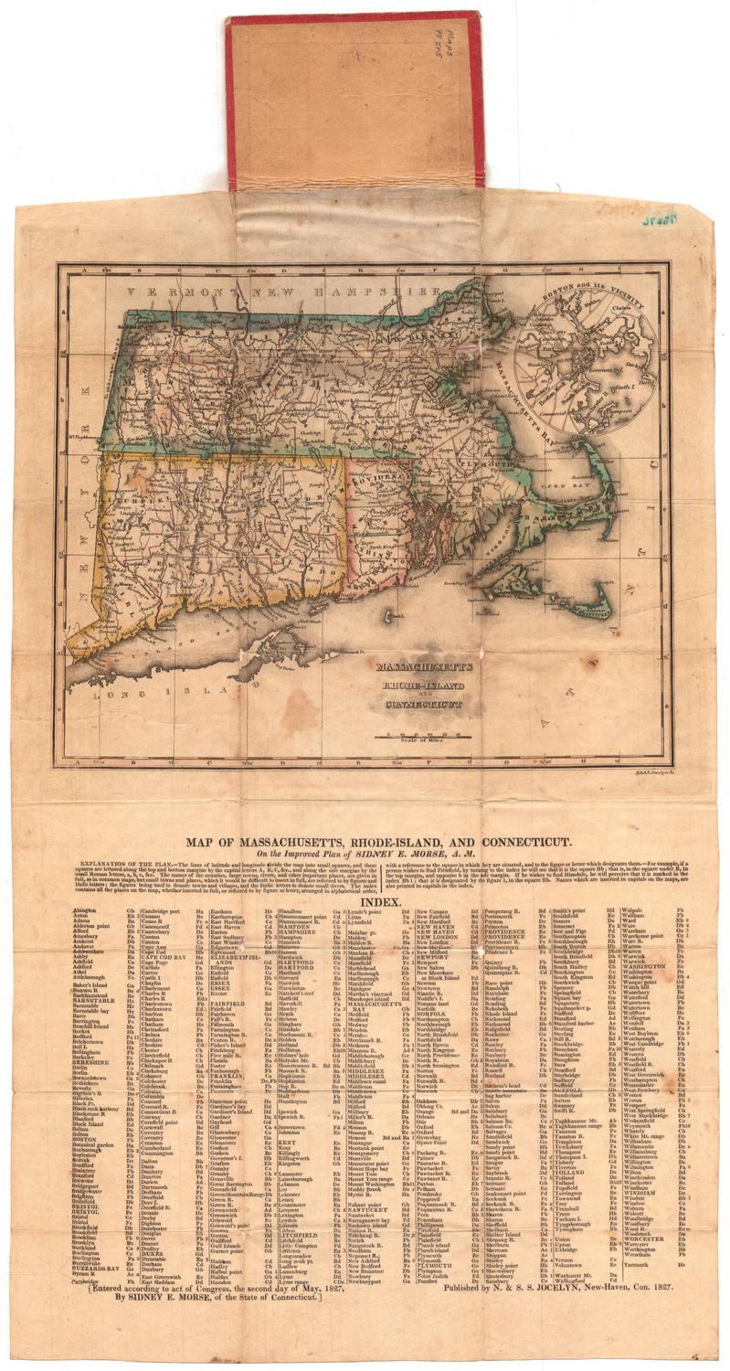
Connecticut and Rhode Island
PublisherPublished by
Thomas Gamaliel Bradford
(American, 1802 - 1887)
Date1835
MediumEngraving; black printer's ink and watercolor on wove paper
DimensionsPrimary Dimensions (image height x width): 7 3/4 x 10 1/8in. (19.7 x 25.7cm)
Platemark (height x width): 8 7/8 x 11 3/8in. (22.5 x 28.9cm)
Sheet (height x width): 9 1/2 x 12 1/2in. (24.1 x 31.8cm)
ClassificationsGraphics
Credit LineMuseum purchase
Object number1979.96.4
DescriptionMap of Connecticut and Rhode Island, with Massachusetts to the north and east, Long Island and the Long Island Sound to the south, and New York to the west. Connecticut is outlined in red with its counties outlined in green; Rhode Island is outlined in green with its counties outlined in red. Towns are marked with circles. The two proposed railroads depicted are one route between Waterford, Connecticut to the Massachusetts border, and between Stonington, Connecticut and Providence, Rhode Island. The Farmington Canal and the Blackstone Canals are shown as finished canals, with one proposed canal appearing in the northwest corner of Connecticut. Physical features include elevation, conveyed with hachure marks, rivers, ponds, and islands.
Label TextBy 1835, map printing and publishing was becoming big business, and that business was increasingly centered in Philadelphia. Other cities, however, remained important centers of map production, among them Hartford and Boston. Thomas Gamaliel Bradford was an assistant editor for the American Encyclopedia in Boston when he became interested in maps and atlases. This map of Connecticut and Rhode Island was included in Bradford's first atlas, A Comprehensive Atlas Geographical, Historical and Commercial, which was based on a French work by Adrian Balbi. In addition to maps, the volume also included comparative tables and statistical charts.
NotesCartographic Note: Scale: 1 inch equals 15 milesStatus
Not on view

Object/Object