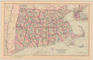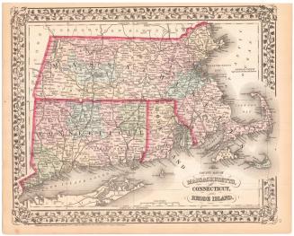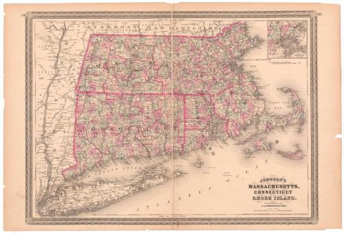
Johnson's Massachusetts, Connecticut and Rhode Island
PublisherPublished by
Alvin Jewett Johnson
(American, 1827 - 1884)
Date1864
MediumLithography; printer's ink and watercolor on wove paper
DimensionsPrimary Dimensions (image height x width): 16 7/8 x 23in. (42.9 x 58.4cm)
Sheet (height x width): 18 x 26 1/2in. (45.7 x 67.3cm)
Sheet (height x width): 18 x 26 1/2in. (45.7 x 67.3cm)
ClassificationsGraphics
Credit LineMuseum purchase
DescriptionMap of Massachusetts, Connecticut, and Rhode Island, with portions of New York State to the west, Vermont and New Hampshire to the north, Massachusetts Bay and Cape Cod Bay to the east, and Long Island and the Atlantic Ocean to the south. Towns, counties, railroads, major rivers, and lighthouses are shown. An inset map shows the city of Boston and surrounding towns.
Object number1979.96.3
NotesCartographic Note: 2 7/8 inches = 30 milesOn View
Not on view