Connecticut
PublisherPublished by
Unknown
Date1869-1871
MediumLithography; black printer's ink and yellow watercolor on wove paper
DimensionsPrimary Dimensions (image height x width): 11 1/8 x 13 7/8in. (28.3 x 35.2cm)
Sheet (height x width): 14 x 16 5/8in. (35.6 x 42.2cm)
Sheet (height x width): 14 x 16 5/8in. (35.6 x 42.2cm)
ClassificationsGraphics
Credit LineMuseum purchase
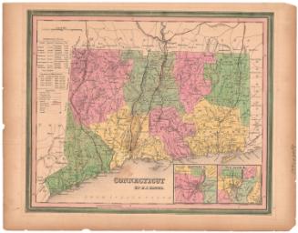
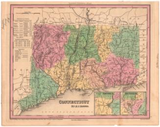
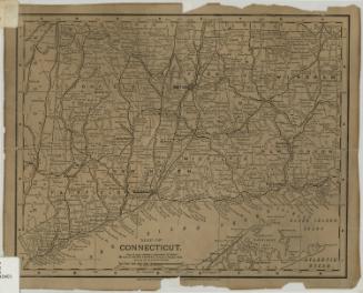
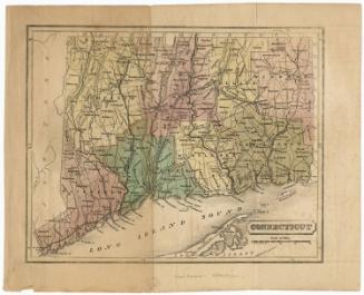
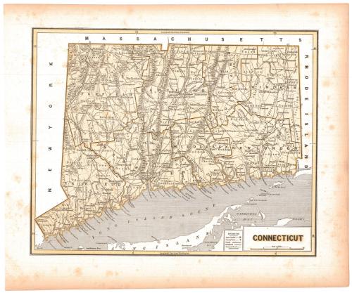
DescriptionMap of the state of Connecticut, from Massachusetts to the north, Rhode Island to the east, the north shore of Long Island and the Long Island Sound to the south, and New York to the west. The state is divided into counties, outlined in solid black lines and labeled in capital letters; and towns, outlined in thin solid black lines and labeled. Broken solid black lines are used as part of the boundary lines between Tolland and New London Counties and Middlesex and New Haven Counties, but no explanation is given. Hartford and New Haven are both shown as state capitals. Canals, railroads and common roads are indicated with different lines but are labeled. Rivers are shown, with large rivers labeled. Elevation is conveyed through hachure marks.
Object number1979.96.2
NotesCartographic Note: Scale: 5/8 inches equals 5 miles
Date Note: Map probably dates between 1869, when Plainville was incorporated, and 1871, when Newington was incorporated. Plainville appears on the map; Newington does not.On View
Not on view