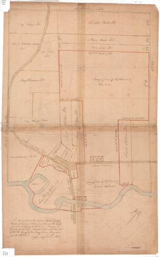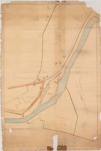
This plan represents two pieces or tracts of land viz one and the largest the property of A. & S. Jillson, the other belonging to Seth Jillson situated in Willimantic...
SurveyorSurveyed by
Charles Warner
(American, active 1849)
Date1849
MediumDrawing; black ink and blue watercolor on wove paper
DimensionsPrimary Dimensions (image height x width): 17 7/8 x 21 3/4in. (45.4 x 55.2cm)
Sheet (height x width): 17 7/8 x 21 3/4in. (45.4 x 55.2cm)
ClassificationsGraphics
Credit LineConnecticut Museum of Culture and History collection
Object number2006.119.0
DescriptionManuscript map of two plots of land in Willimantic, Connecticut. Both pieces of land abut the turnpike road to Providence. Georgraphic coordinates and measurements in rods and links are provided for each of the property lines. In the smaller plot of land, a house and barn are shown.
Label TextThe brothers Asa and Seth Jillson were among the founders of Willimantic's textile industry. Asa, the elder brother, had died in 1848, a year before this map was made, perhaps in connection with a property settlement. The firm name still appears as A. & S. Jillson, despite the fact that one of the brothers was deceased. Asa's son, William L. Jillson, would also be active in the textile business, participating the huge expansion of the mills that took place beginning in the 1850s. William L. Jillson drew an early map of Willimantic village in the Connecticut Historical Society's collection.
NotesCartographic Note: Scale: 1 inch equals 2 rodsStatus
Not on view
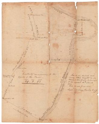
Erastus Worthington
1907