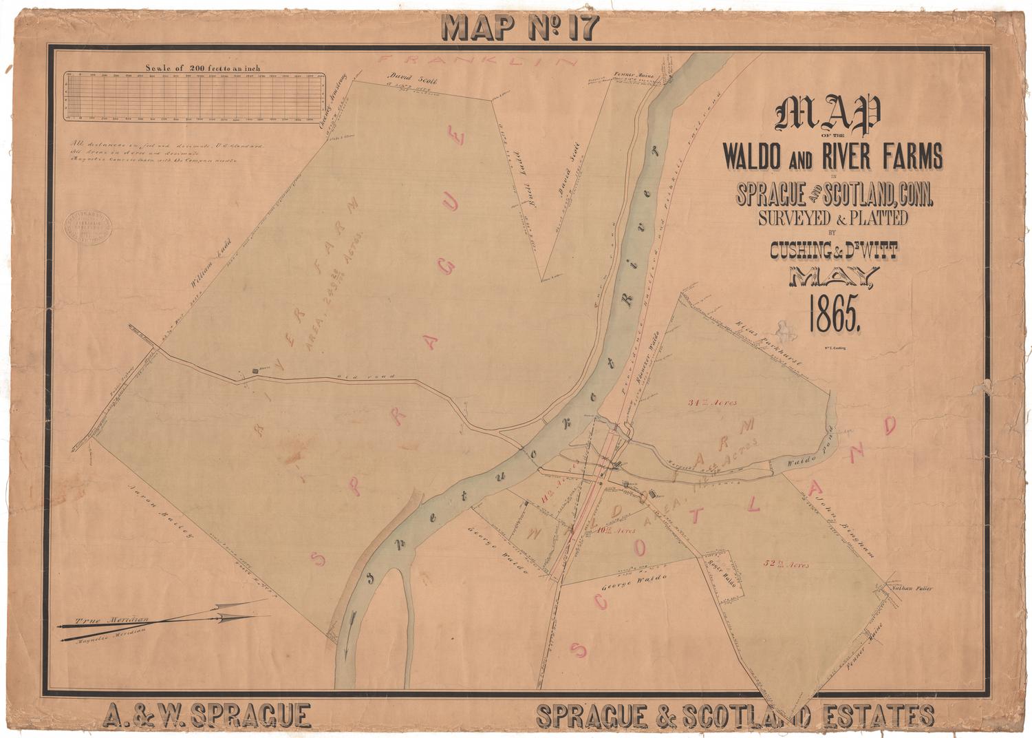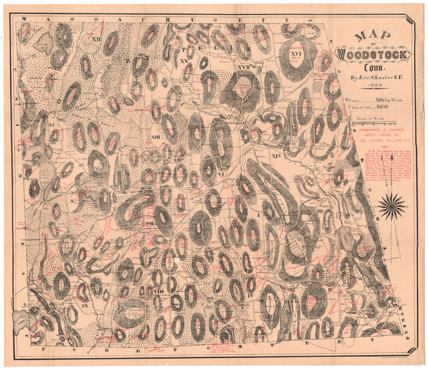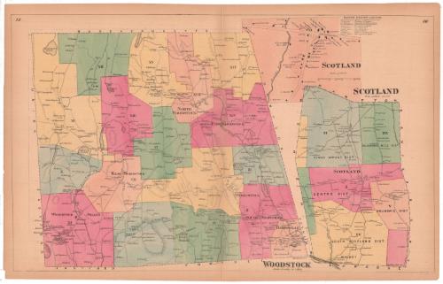
Woodstock
SurveyorSurveyed by
Ormando Willis Gray
(American, born 1829)
PrinterPrinted by
Kellogg & Bulkeley
(American, 1867 - 1990)
PublisherPublished by
C. G. Keeney
(American, about 1810 - 1888)
Date1869
MediumLithography; black printer's ink and watercolor on wove paper
DimensionsPrimary Dimensions (image height x width): 16 7/8 x 27 1/2in. (42.9 x 69.9cm)
Sheet (height x width): 18 1/4 x 28 1/2in. (46.4 x 72.4cm)
Sheet (height x width): 18 1/4 x 28 1/2in. (46.4 x 72.4cm)
ClassificationsGraphics
Credit LineConnecticut Museum of Culture and History collection
DescriptionMaps of Woodstock and Scotland, Connecticut, printed side-by-side on the same sheet. Woodstock extends from the border of Massachusetts to the north, Thompson and Putnam to the east, Eastford and Pomfret to the south, and Union and Eastford to the west. The town is divided into seventeen numbered districts and Harrisville, which is unnumbered. Local roads are depicted but not labeled, and black squares presumably indicate the presence of buildings, which are labeled with their owner's name. Natural features include elevation, conveyed with hachure marks, and lakes, ponds and brooks.
Scotland extends from Hampton to the north, Canterbury to the east, Sprague to the south, and Windham to the west. It is divided into five numbered districts plus two unnumbered sections. Local roads are depicted but not labeled, and black squares presumably indicate the presence of buildings, which are labeled with their owner's name. Natural features include the Shetucket River and Merricks Brook.
Between the two maps is an inset of Scotland. Local roads are depicted but not labeled, and black squares presumably indicate the presence of buildings, which are labeled with their owner's name. Merricks Brook runs through the featured portion of the town. Next to the inset is a business directory of Scotland.
Object number2006.116.0
NotesCartographic Note: Scale, Woodstock: 2 inches equals 1 mile; Scotland: 1 inch equals 100 rods; Scotland (inset): 3/8 inches equals 10 rodsOn View
Not on view