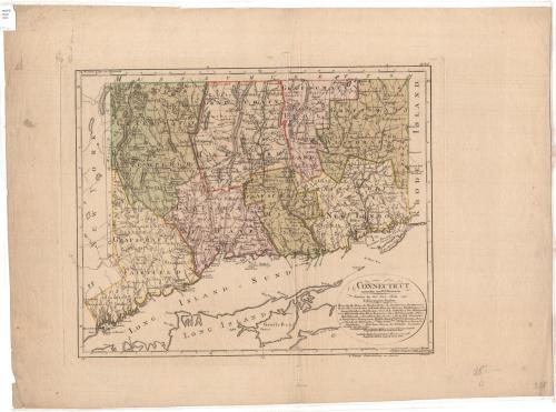
Connecticut
DraftsmanDrawn by
Daniel Friedrich Sotzmann
(German, 1754 - 1840)
PrintmakerEngraved by
F. Schmidt
(German, active1796)
PublisherPublished by
Carl Ernst Bohn
(German, active 1781 - 1816)
Date1796
MediumEngraving; black printer's ink and watercolor on wove paper
DimensionsPrimary Dimensions (image height x width): 14 1/8 x 17 1/4in. (35.9 x 43.8cm)
Platemark (height x width): 15 1/8 x 18 3/4in. (38.4 x 47.6cm)
Sheet (height x width): 19 1/2 x 26 3/8in. (49.5 x 67cm)
Platemark (height x width): 15 1/8 x 18 3/4in. (38.4 x 47.6cm)
Sheet (height x width): 19 1/2 x 26 3/8in. (49.5 x 67cm)
ClassificationsGraphics
Credit LineMuseum purchase
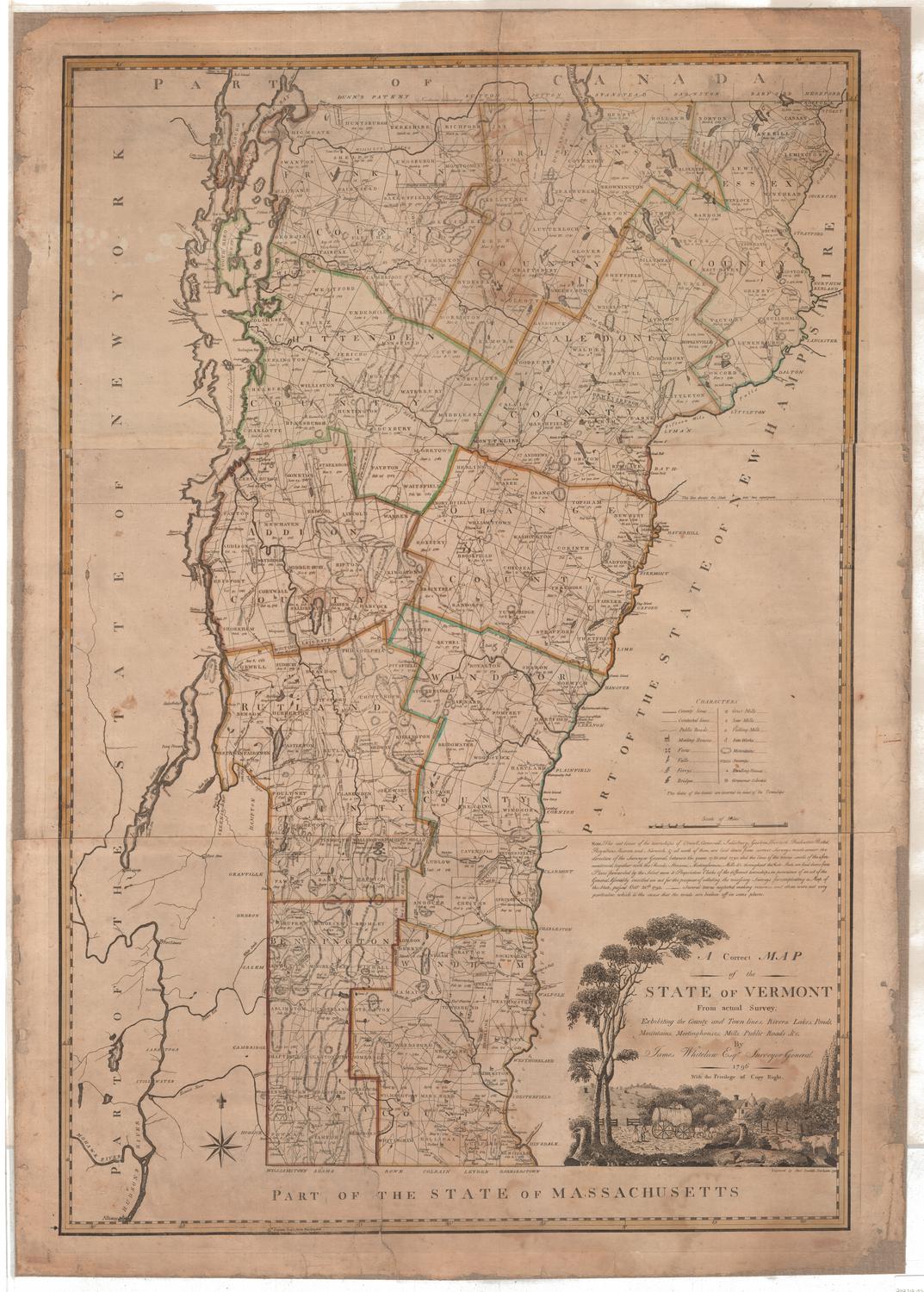
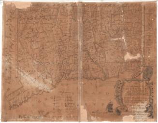
DescriptionPolitical and physical map of the state of Connecticut with Massachusetts to the north, Rhode Island to the east, part of Long Island and Long Island Sound to the south, and New York to the west. Names are given in German and sometimes in English. The boundaries of both towns and counties are indicated. Post roads and other roads are shown. Symbols indicate the location of Congregational, Presbyterian, and Baptist churches, courthouses, academies, gristmills, sawmills, fulling mills, oil mills, paper mills, powder mills, distilleries, iron works, potash works, and fortifications. Some rivers and lakes are identified. Hills and mountains are indicated with hachure marks. The map provides considerable detail for the islands and other features along the Connecticut coast of Long Island Sound.
Object number1956.92.0
NotesCartographic Note: Scale is given in English and German milesOn View
Not on view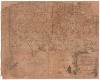
Joel Knott Allen
1791 or 1792