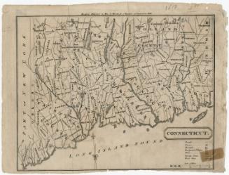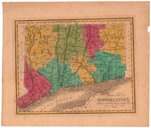
Map of Connecticut
PublisherPublished by
Parsons & Hills
(American, 1835 - 1844)
Date1835
MediumEngraving; black printer's ink and watercolor on wove paper
DimensionsPrimary Dimensions (image height x width): 8 3/8 x 10 11/16in. (21.3 x 27.1cm)
Platemark (height x width): 8 7/8 x 11 1/4in. (22.5 x 28.6cm)
Sheet (height x width): 11 1/8 x 13 1/4in. (28.3 x 33.7cm)
ClassificationsGraphics
Credit LineGift of Avis and Rockwell Gardiner
Object number1966.79.0
DescriptionMap of the state of Connecticut, with the border of Massachusetts to the north, Rhode Island to the east, part of Long Island and the Long Island Sound to the south, and New York to the west. Connecticut is divided into counties, marked with dotted lines and labeled, and towns, also labeled and delineated with solid lines. Roads are conveyed through solid lines. Elevation is portrayed through hachure marks. Rivers, ponds and lakes, points, reefs and islands are shown.
Label TextParsons and Hills were Hartford book publishers; it is likely that this modest map appeared in one of their publications. Unlike many nineteenth-century Connecticut maps published outside the state, this one appears to be fairly accurate and up to date. It includes the towns of North Branford, incoroporated in 1831, and Bethany, incorporated in 1832. The Farmington Canal is prominently feautred, but no railroads are shown, though some were in the early planning stages. The Stonington Railroad would be completed in 1837; the first segment of the Hartford & New Haven Railroad would open in 1838, and the Norwich & Worcester Railroad in 1840.
NotesCartographic Note: No scaleStatus
Not on view