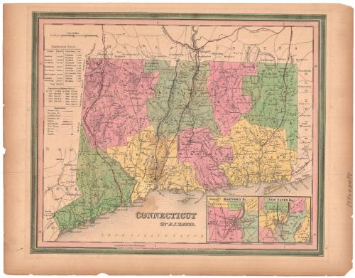
Connecticut
MakerMade by
Henry Schenck Tanner
(American, 1786 - 1858)
Date1839
MediumEngraving; black printer's ink and watercolor on wove paper
DimensionsPrimary Dimensions (image height x width): 12 x 14 5/8in. (30.5 x 37.1cm)
Platemark (height x width): 12 1/2 x 15 1/8in. (31.8 x 38.4cm)
Sheet (height x width): 13 1/2 x 17 3/8in. (34.3 x 44.1cm)
ClassificationsGraphics
Credit LineBarbour Fund
Object number1943.10.1
DescriptionMap of the state of Connecticut, with the border of Massachusetts to the north, Rhode Island to the east, the Long Island Sound to the south, and New York to the west. The state is divided into counties, which are labeled and delineated with broken solid lines, and towns, which are also labeled and delineated with solid lines. "Leading roads," common roads, canals and railroads are the transportation routes shown, marked with different lines. The locations of courthouses, churches and taverns are also shown and marked with different symbols. Natural features include elevation, conveyed with hachure marks, ponds and lakes, islands and points. In the bottom right corner are two inset maps of Hartford and New Haven. To the left of the map is a statistical table containing information about the populations of various counties and towns in Connecticut, as well as historical population data.
Label TextThe copyright notice of the second edition of H. S. Tanner's map of Connecticut is dated 1839 and it appeared in the second edition of Tanner's A New American Atlas in 1841. The plate has been updated; the route of the Stonington & Providence Railroad, which was incorrect in the 1834 first edition, has been corrected, and the Norwich & Worcester Railroad, the Hartford & New Haven Railroad, and the Housatonic Railroad have all been added. The towns have been updated as well, and Prospect, Avon, and Bethany, all of which were omitted from the first edition, are now all included. Other new towns, incorporated since 1834, include Bloomfield (1835), Westport (1835), Chester (1836), Ledyard (1836), and Clinton (1838). Even East Lyme, incorporated in 1839, appears on this map, which was issued in that year, so unlike many nineteenth-century maps, this one was both accurate and up-to-date when it first appeared.
NotesCartographic Note: Scale: 9/16 inches equals 5 milesStatus
Not on view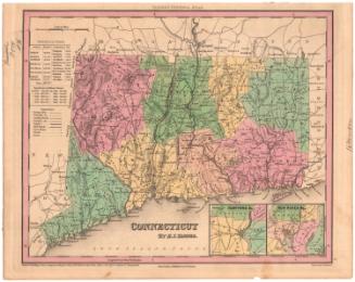


H. F. Sumner & Co.
1833
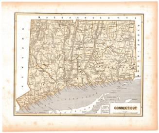

Lucius Stebbins & Co.
1859