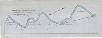
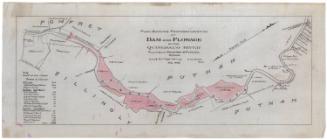
Plan showing proposed dam and flowage on the Quinebaug River, Killingly, Pomfret, and Putnam, Connecticut
SurveyorSurveyed by
Erastus Worthington
(American, 1863 - 1953)
Date1907
MediumDrawing; ink and watercolor on drafting linen
DimensionsPrimary Dimensions (image height x width): 30 x 70in. (76.2 x 177.8cm)
Sheet (height x width): 34 x 74in. (86.4 x 188cm)
Sheet (height x width): 34 x 74in. (86.4 x 188cm)
ClassificationsGraphics
Credit LineConnecticut Museum of Culture and History collection
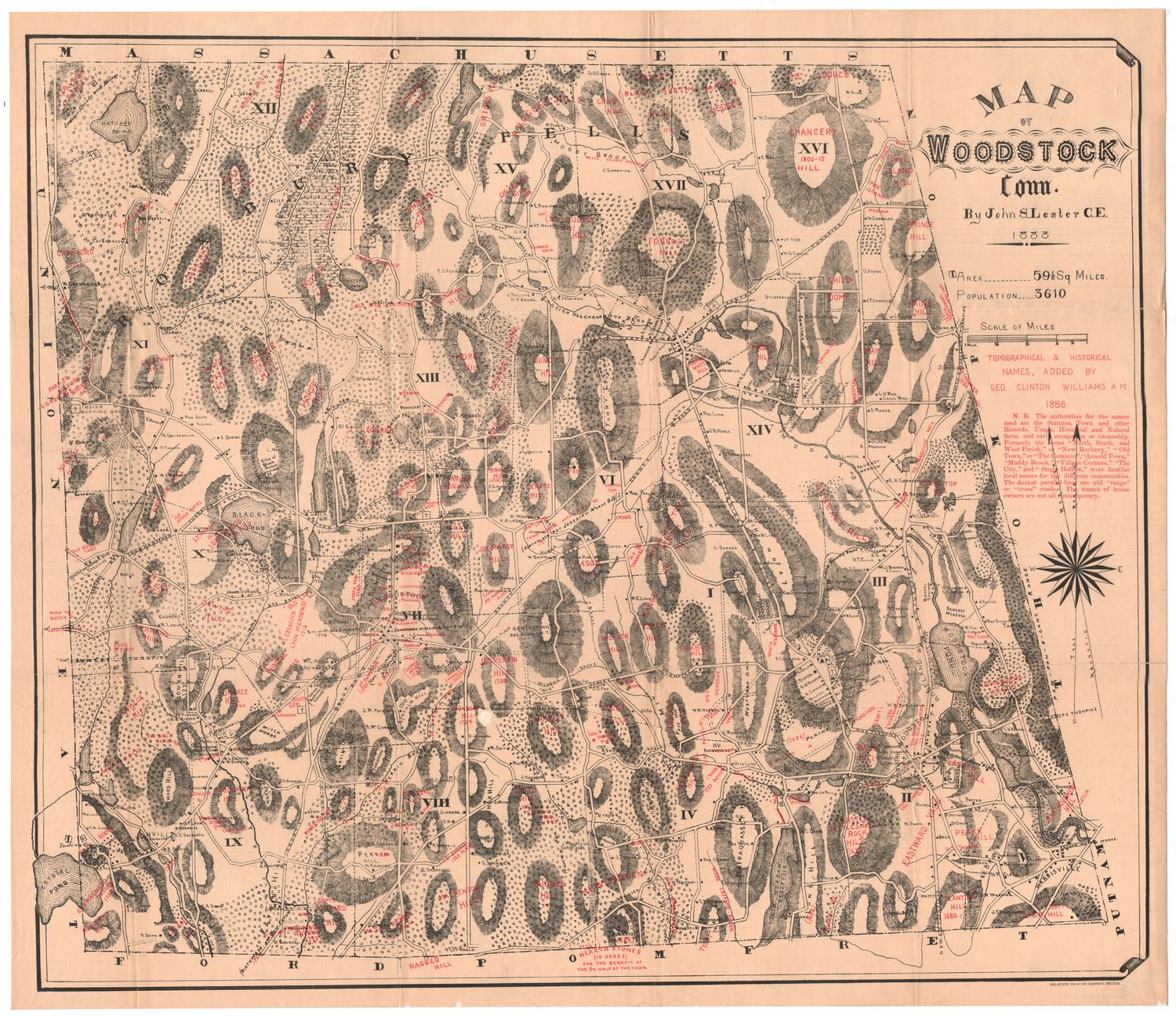
DescriptionMap of several plots of land along the Quinebaug River in Killingly, Pomfret, and Putnam, Connecticut. Owners include, in Killingly: George W. Butts, Chester E. Child, Thomas Dunn, J. W. and Ethelyn A. Atwood, and Gilbert Tracey; in Pomfret: Mrs. Horace Whipple and Fremont S. Bruce; in Putnam: A. E. Covill, Frank Hopkins, John A. Carpenter, Lawson Bowen, the Methodist Church of Putnam, the Roman Catholic Church of Putnam, J. B. Kent, David Clark, Partello, E. W. Wheaton, Sidney Heath, the Putnam Fair and Park Corporation, P. Foisey, Nelse Leclaire, W. Murray, and Peter Gardiner. The Consolidated Street Railroad and the New York, New Haven, and Hartford Railroad are shown. Roads include Williamsville Road, Pomfret Road, and Attawaugan Road. The site of the proposed dam is indicated by a red line. The area that will be flooded is outlined in black and shaded with blue watercolor. A compass indicates that magnetic north is towards the upper right corner of the map.
Object number2012.312.268
NotesCartographic Note: 1 inch equals 300 feetOn View
Not on view
Erastus Worthington
1907

1890-1910