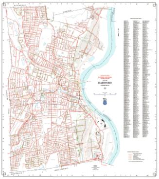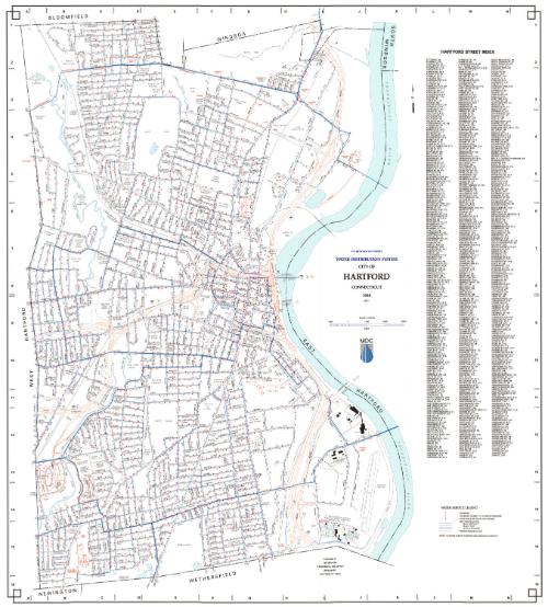
City of Hartford Water Distribution System
MakerPrepared by
Metropolitan District Commission
(American, founded 1929)
Date1998
MediumLithography; black and colored printer's inks on wove paper
DimensionsPrimary Dimensions (image height x width): 32 1/8 x 29in. (81.6 x 73.7cm)
Sheet (height x width): 32 3/4 x 29 3/4in. (83.2 x 75.6cm)
ClassificationsGraphics
Credit LineConnecticut Museum of Culture and History collection
Object number2012.312.261
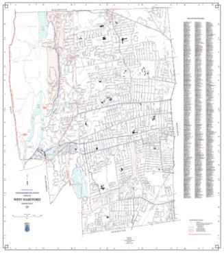
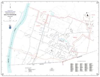
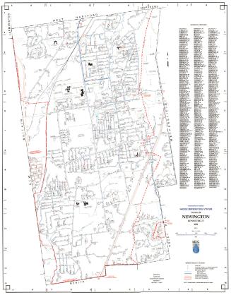
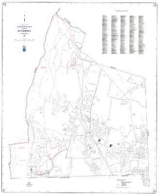
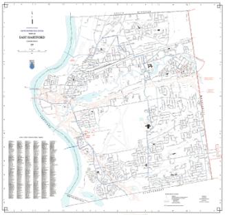
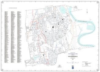
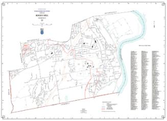
DescriptionMap of the city of Hartford with Bloomfield to the north, the Connecticut River to the east, Wethersfield and Newington to the south, and West Hartford to the west. Streets, interstate highways, highway interchanges, railroads, streams, and ponds are indicated. A Water Service Legend at lower right provides a key to hydrants, hydrants subject fo pumped pressure, gate valves (sixteen inch main or larger), MDC water mains (less than six inches in diameter, six to twenty-three inches in diameter, and twenty-four inches or larger in diameter), and private water mains. MDC water mains are shown in blue; private water mains are shown in red. Hydrants located on private water mains are not shown.
Label TextThe adoption of the computer mapping technology known as GIS by the Metropolitan District Commission in 1988 made it easier than ever before to update and generate maps. Mapping had always been a function of the Metropolitan District Commission, which needed accurate maps in order to see the water distribution and sanitary sewer systems of its member towns. By the early twenty-first century, interactie maps would be available online on the Commission's website.
NotesCartographic Note: 1 inch equals 1000 feetStatus
Not on view