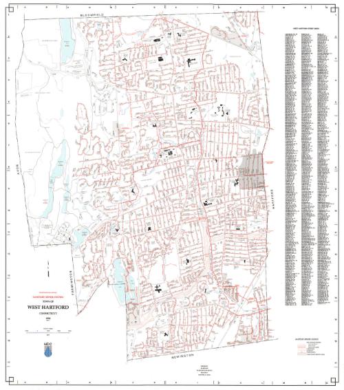
Town of West Hartford Sanitary Sewer System
MakerPrepared by
Metropolitan District Commission
(American, founded 1929)
Date1998
MediumLithography; black and colored printer's inks on wove paper
DimensionsPrimary Dimensions (image height x width): 35 1/4 x 31in. (89.5 x 78.7cm)
Sheet (height x width): 35 1/2 x 31 3/4in. (90.2 x 80.6cm)
Sheet (height x width): 35 1/2 x 31 3/4in. (90.2 x 80.6cm)
ClassificationsGraphics
Credit LineConnecticut Museum of Culture and History collection
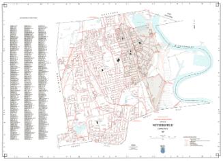
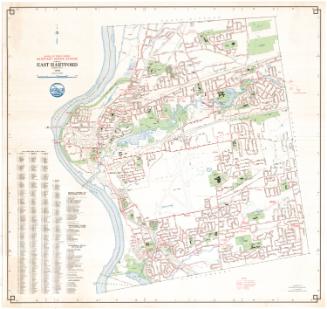
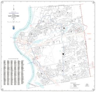
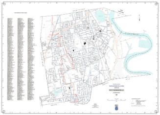
DescriptionMap of the town of West Hartford with Bloomfield to the north, Hartford to the east, Newington to the south, and Avon and Farmington to the west. Streets, highways, and highway intersections are shown. Streams include Trout Brook and the South Branch of the Park River. Bodies of water include Wood Pond, Woodbridge Lake, Dyke Pond, and Reservoirs Nos. 1, 2, 3, 5 and 6. Sewer lines are indicated in red. A Sanitary Sewer Legend at lower right provides a key to sewers six to twenty-three inches in diameter, sewers twenty-four inches or large in diameter, force mains, manholes, pump stations, and pump station service areas. A key to West Hartford streets is at the right. An arrow pointing north is at lower left.
Object number2012.312.256
NotesCartographic Note: 1 inch equals 1000 feetOn View
Not on view