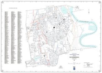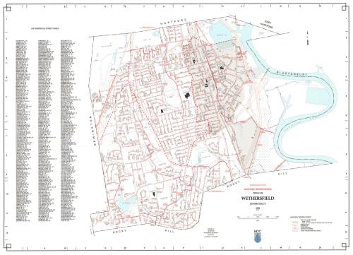
Town of Wethersfield Sanitary Sewer System
MakerPrepared by
Metropolitan District Commission
(American, founded 1929)
Date1998
MediumLithography; black and colored printer's inks on wove paper
DimensionsPrimary Dimensions (image height x width): 25 1/2 x 35 1/2in. (64.8 x 90.2cm)
Sheet (height x width): 26 x 36 1/4in. (66 x 92.1cm)
ClassificationsGraphics
Credit LineConnecticut Museum of Culture and History collection
Object number2012.312.252
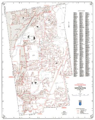
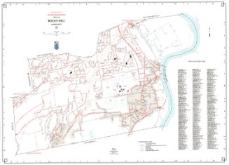
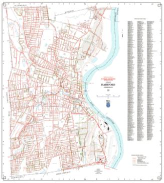
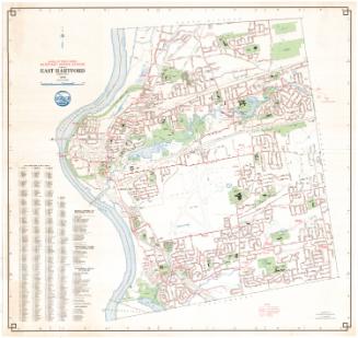
DescriptionMap of the town of Wethersfield, Connecticut with Hartford and East Hartford to the north, the Connecticut River to the east, Rocky Hill to the south, and Newington to the west. A small triangle belonging to Wethersfield labeled "Hockanum Meadow" is on the east side of the Connecticut River. Streets, interstate highways and highway intersections, railroads, streams, and ponds are shown with water mains indicated in blue and red. The town includes much open space, mostly marshy. A Sanitary Sewer Legend at lower right provides a key to sewers six to twenty-three inches in diameter, sewers twenty-four inches or large in diameter, force mains, manholes, pump stations, and pump station service areas. A key to Wethersfield streets is at the left. Sewers to the north are tributary to the Hartford Water Pollution Control Facility. Sewers to the south are tributary to the Rocky Hill Water Pollution Control Facility.
Label TextSome of Wethersfield's sewer pipes were installed as early as 1914, long before the creation of the Metropolitan District Commission in 1929. By 1998, the system was aging, and old cracked pipes were unable to handle large amounts stormwater during heavy rains, leading to the overflow of raw sewage into basements and into Wethersfield Cove and the Connnecticut River. Wethersfield's aging sewer system would remain a cause for concern during the following decades.
NotesCartographic Note: 1 inch equals 1000 feetStatus
Not on view