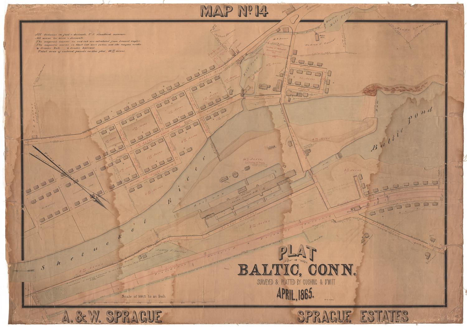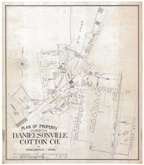
Plan of Property belonging to the Danielsonville Cotton Co.
SurveyorSurveyed by
Samuel B. Cushing Jr.
(American, 1846 - 1888)
DraftsmanDrawn by
Samuel B. Cushing Jr.
(American, 1846 - 1888)
Date1880
MediumDrawing; black and red ink and watercolor on tracing linen
DimensionsPrimary Dimensions (inage height x width): 34 x 29 1/2in. (86.4 x 74.9cm)
Sheet (height x width): 36 x 30 3/4in. (91.4 x 78.1cm)
Sheet (height x width): 36 x 30 3/4in. (91.4 x 78.1cm)
ClassificationsGraphics
Credit LineConnecticut Museum of Culture and History collection
DescriptionMap showing buildings in the area of Main Street, Maple Street, Cottage Street, Water Street, Back Street, and Furnace Street in Danielson, Connecticut. Buildings include mills, sheds, dwellings, barns, a boarding house and two blacksmith shops. The large new mill has a boiler room and an engine room. The owners of the dwellings are not indicated; presumably these buildings belonged to the Danielsonville Cotton Company. The Danielsonville Cotton Company's mill pond is to the north. Furnace Street and the Norwich and Worcester Railroad are to the east. The Quinebaug Company's pond is to the west. Dams, gates, a raceway, and iron bolts are also shown along the Five Mile River. A sixteen-point compass rose pointing to magnetic north is at the upper left.
Object number2012.312.242
NotesCartographic Note: One inch equals fifty feet
Subject Note: Danielson, a mill village in the town of Killingly, was known as Danielsonville until 1895.On View
Not on view