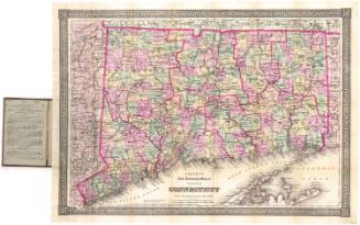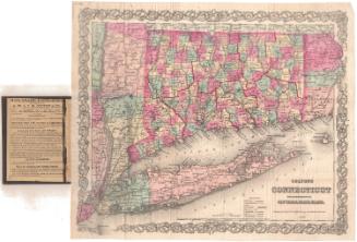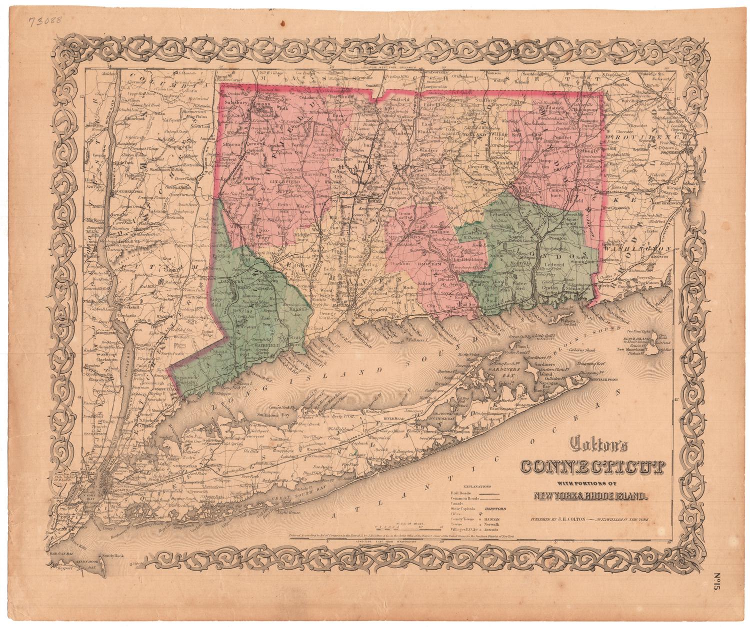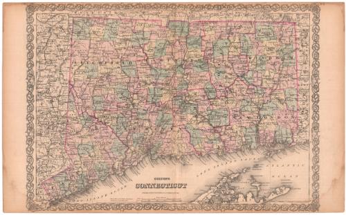
Colton's Connecticut
PublisherPublished by
G.W. & C.B. Colton & Co.
(American, founded 1865)
Date1879
MediumLithography; black printer's ink and watercolor on wove paper
DimensionsPrimary Dimensions (image height x width): 17 1/4 x 24 1/4in. (43.8 x 61.6cm)
Sheet (height x width): 17 1/2 x 28 1/4in. (44.5 x 71.8cm)
Sheet (height x width): 17 1/2 x 28 1/4in. (44.5 x 71.8cm)
ClassificationsGraphics
Credit LineMuseum purchase
DescriptionMap of Connecticut, with Massachusetts to the north, Rhode Island to the east, part of Long Island and the Long Island Sound to the south, and New York to the west. The state is divided into counties, denoted with broken solid and dotted lines, and towns, denoted with broken solid lines. Natural features depicted include rivers, ponds, lakes, islands, points and harbors. Population centers are denoted with criss-crossing lines that probably represent streets. The New York and New Haven; Danbury and Norwalk; Housatonic; New Haven and Northampton; Naugatuck; Boston and New York Air Line; and the New York and New England, railroad lines are shown and labeled. On the back there is text describing Missouri, Montana, Minnesota and Mississippi, under the heading, "The United States of America," indicating that this map came from an atlas.
Object number1981.143.2
NotesCartographic Note: Scale: 1:300,000On View
Not on view