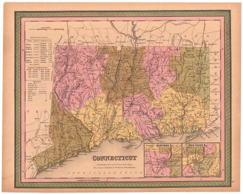
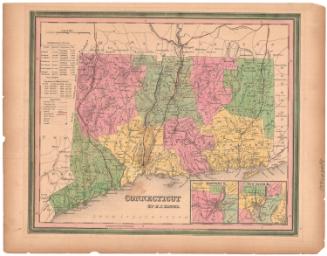
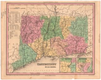
Connecticut
PublisherPublished by
Samuel Augustus Mitchell
(1792 - 1868)
Dateabout 1849
MediumEngraving; black printer's ink and watercolor on wove paper
DimensionsPrimary Dimensions (image height x width): 12 1/8 x 14 7/8in. (30.8 x 37.8cm)
Sheet (height x width): 13 x 16 5/8in. (33 x 42.2cm)
Sheet (height x width): 13 x 16 5/8in. (33 x 42.2cm)
ClassificationsGraphics
Credit LineMuseum purchase
DescriptionMap of the state of Connecticut, with the border of Massachusetts to the north, Rhode Island to the east, the Long Island Sound to the south, and New York to the west. The state is divided into counties, which are labeled and delineated with broken solid lines, and towns, which are also labeled and delineated with solid lines. "Leading roads," common roads, canals and railroads are the transportation routes shown, marked with different lines. The locations of courthouses, churches and taverns are also shown and marked with different symbols. Natural features include elevation, conveyed with hachure marks, ponds and lakes, islands and points. In the bottom right corner are two inset maps of Hartford and New Haven. To the left of the map is a statistical table containing information about the populations of various counties and towns in Connecticut, as well as historical population data.
Object number1981.143.1
NotesCartographic Note: Scale: About 9/16 inches equals 5 milesOn View
Not on view


H. F. Sumner & Co.
1833