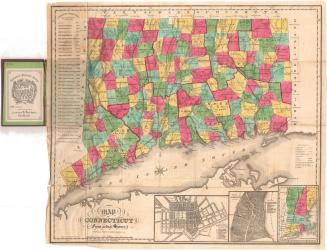
Map of Connecticut Showing Counties, Senatorial Districts and Towns
PrinterPrinted by
Kellogg & Bulkeley
(American, 1867 - 1990)
Date1888
MediumLithograph; black and colored printer's inks on wove paper
DimensionsPrimary Dimensions (image height x width): 10 7/8 x 13 3/4in. (27.6 x 34.9cm)
Sheet (height x width): 11 7/8 x 14 7/8in. (30.2 x 37.8cm)
ClassificationsGraphics
Credit LineGift of Debra Lenentine
Object number2005.185.0
DescriptionMap of Connecticut, with the border of Massachusetts to the north, Rhode Island to the east, the Long Island Sound to the south, and New York to the west. The state is divided into counties, which are labeled and outlined in solid red and black lines; towns, which are labeled and outlined in broken solid lines; and 35 senatorial districts, which are numbered and outlined in red lines. Inset maps in the lower right corner depict the Waterbury, Hartford, Bridgeport, and New Haven districts. To the left of the map is a list of the congressional districts. Railroads depicted include the New York, New Haven and Hartford; Danbury and Norwalk; Housatonic; New York and New England; Shepaug; Hartford and Connecticut Western; Boston and New York Air Line; New Haven and Northampton; New London Northern; and Norwich and Worcester Railroads.
Label TextOnce the results of the Federal Census of 1880 became known, it was clear that population growth, especially in the major cities, meant that existing division of the state of Connecticut into twenty-one senatorial districts was badly out-of-date. In 1881, the legislature voted to increase the number of senatorial districts to twenty-four, giving one additional senator each to Hartford, Fairfield, and New Haven Counties. These twenty-four districts are outlined in red on this 1888 map, which was issued as part of the Register and Manual of the State of Connecticut by the Secretary of State. The towns themselves continued to serve as the districts for electing representatives to the lower house of the state assembly, even though this produced gross inequality in the representation of small towns versus large cities. This discrepancy would not be corrected until 1960.
NotesCartographic Note: Scale: 1 inch equals 7 1/2 milesStatus
Not on view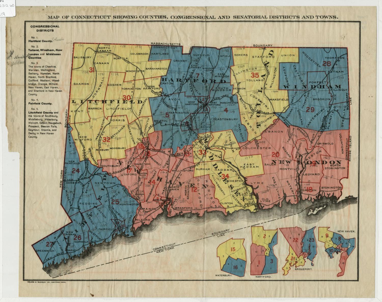
Kellogg & Bulkeley
1910-1915
Kellogg & Bulkeley
1915-1920