Town of West Hartford, Connecticut
MakerPrepared by
Metropolitan District Commission
(American, founded 1929)
Date1995
MediumLithography; black and colored printer's inks on wove paper
DimensionsPrimary Dimensions (image height x width): 35 x 31in. (88.9 x 78.7cm)
Sheet (height x width): 35 1/2 x 31 1/2in. (90.2 x 80cm)
ClassificationsGraphics
Credit LineConnecticut Museum of Culture and History collection
Object number2012.312.244
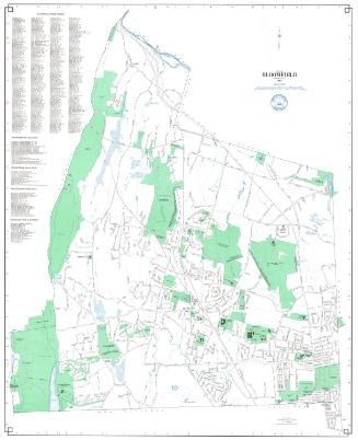
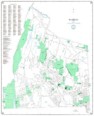
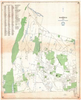
DescriptionMap of the town of West Hartford with Bloomfield to the north, Hartford to the east, Newington to the south, and Avon and Farmington to the west. Streets, highways, and highway intersections are shown. Streams include Trout Brook and the South Branch of the Park River. Bodies of water include Wood Pond, Woodbridge Lake, Dyke Pond, and Reservoirs Nos. 1, 2, 3, 5 and six. Also shown are the Metropolitan District Water Treatment Plant, the Burnt Hill Reservoir Flood Control Dike, and the Talcott Mountain Flood Control Dike. Cemeteries, golf course, and numerous parks are indicated. Extensive text at the right includes an Index of West Hartford Streets, and lists of Educational Facilities, Government Facilities, Recreational Facilities, and Places of Public Interest. An arrow at lower left points north.
Label TextBy 1995, West Hartford was largely built-up, with a still-flourishing downtown, shopping malls at Bishops Corner and Corbins Corner, and extensive residential areas. The town also preserved large areas of open space, thanks in part to the Metropolitan District Commission, whose reservoirs occupied large tracts of land in the northwestern part of the town. West Hartford was one of the last towns to join the Metropolitan District, because the town already received its water from the Commisson, according to the original agreement governing the reservoirs.
NotesCartographic Note: 1 inch equals 1000 feetStatus
Not on view