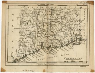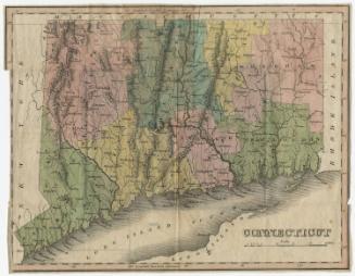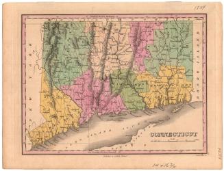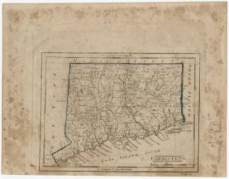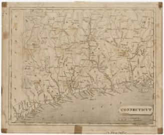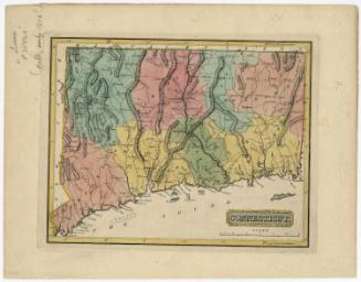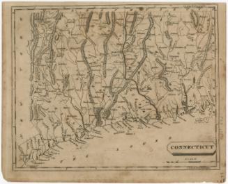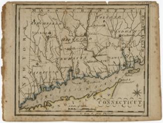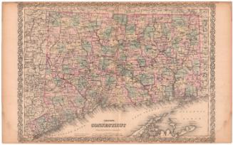
Connecticut
PublisherPublished by
John Warner Barber
(American, 1798 - 1885)
Date1849
MediumEngraving; black printer's ink and watercolor on wove paper
DimensionsPrimary Dimensions (image height x width): 7 3/8 x 9 1/4in. (18.7 x 23.5cm)
Sheet (height x width): 8 7/8 x 11in. (22.5 x 27.9cm)
Sheet (height x width): 8 7/8 x 11in. (22.5 x 27.9cm)
ClassificationsGraphics
Credit LineMuseum purchase
DescriptionMap of Connecticut, with the border of Massachusetts to the north, Rhode Island to the east, part of Long Island and the Long Island Sound to the south, and New York to the west. The state is divided into counties that are outlined in broken solid and dotted lines and labeled, and towns that are outlined in dotted lines and labeled. Population centers appear to be denoted with open circles. Elevation is depicted with clustes of peaks. Railroads and what appear to be local roads are shown. Many small rivers are shown in addition to the Connecticut, Stratford (Housatonic), Thames and Quinebaug Rivers. Harbors, points, islands, and ponds are also depicted.
Object number1938.37.1
NotesCartographic Note: Scale: 1 inch equals about 11 milesOn View
Not on view