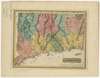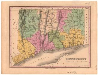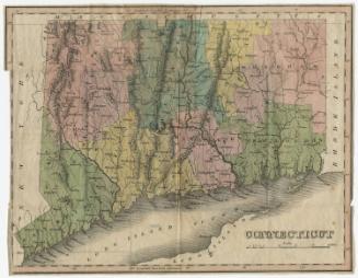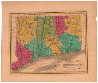
Connecticut
DraftsmanDrawn by
Samuel Lewis
(American, 1754 - 1822)
Date1804
MediumEngraving; black printer's ink and watercolor on paper
DimensionsPrimary Dimensions (image height x width): 7 7/8 x 9 3/4in. (20 x 24.8cm)
Platemark (height only): 8 1/2in. (21.6cm)
Sheet (height x width): 8 3/4 x 10 1/4in. (22.2 x 26cm)
ClassificationsGraphics
Credit LineMuseum purchase
Object number1946.17.2
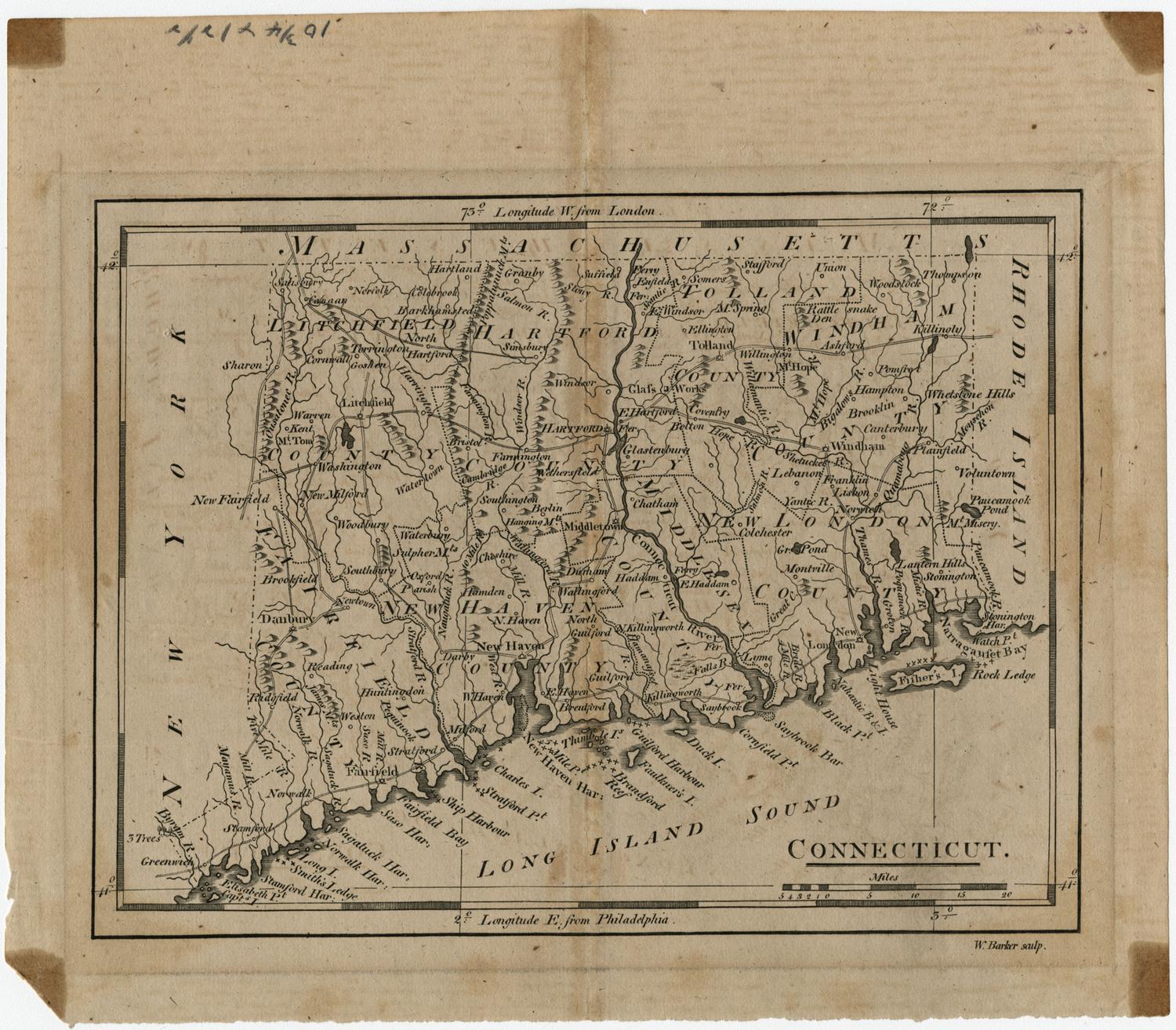
DescriptionThe state of Connecticut, with Massachusetts to the north, Rhode Island to the east, the Long Island Sound to the south, and New York State to the west. The state is divided into counties that are labeled and delineated with dotted lines and colored outlines. Elevation is conveyed with hachure marks, and other natural features include rivers, ponds, islands, harbors, reefs and points. Roads are also shown, along with numbers that presumably represent distances in miles.
Label TextThis appears to be the first edition of Samuel Lewis's map of Connecticut, drawn for A New and Elegant General Atlas, published by John Conrad & Company in Philadelphia in 1804. Already in 1804, it was out-of-date, since it failed to include the towns of New Canaan, Waterford, Sherman, Wilton, and Marlborough, added since 1798. Subsequent editions of the map were not updated and thus became increasingly inaccurate. Keeping up with the changing political makeup of Connecticut during the nineteenth century posed a constant challenge to mapmakers.
NotesCartographic Note: 10 miles to one inchStatus
Not on view