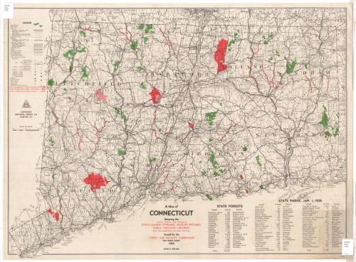
A Map of Connecticut
DraftsmanDrawn by
National Survey Co.
(American, founded 1912)
PublisherPublished by
Connecticut Commission on Forests and Wildlife
(American, 1925 - 1971)
Date1936
MediumLithography; black, green and red printer's inks on wove paper
DimensionsPrimary Dimensions (image height x width): 19 x 26 1/8in. (48.3 x 66.4cm)
Sheet (height x width): 20 x 27in. (50.8 x 68.6cm)
ClassificationsGraphics
Credit LineGift of Mrs. E. S. Holland
Object number1977.120.3
DescriptionMap of Connecticut, with the border of Massachusetts to the north, Rhode Island to the east, and New York to the west. The coastline of Connecticut is shown but the Long Island Sound is not identified. The map shows counties, towns and cities, although its focus is state-owned land and streams. State forests and parks are colored green and state leased or owned shooting grounds, sanctuaries and streams are colored red. Highways, railroads, street-railroads, steamships and canals are all shown. There are lists of the state forests and parks below the map.
Label TextHunting was extremely popular in Connecticut during the Great Depression. Deer were scarce and rabbits were the animals most frequently killed--135,000 rabbits in 1930. Squirrels were the second most frequent quarry, though large numbers of game birds were also brought down by Connecticut hunters. This map shows the large tracts of land that were open for hunting in 1936. Connecticut was unique in having a woman game warden during this period. Miss Edith A. Stoehr of Wethersfield was responsible for providing hunters with instruction in the use of firearms and bird dogs in the field.
NotesCartographic Note: Scale: 1 inch equals 4 miles; 1:250,000Status
Not on view
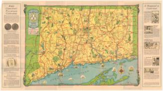
Connecticut State Highway Department
1934