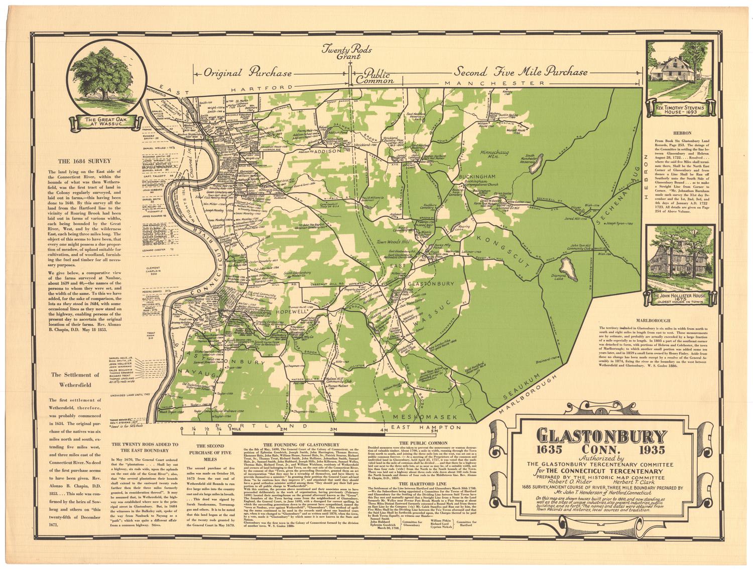
Glastonbury, Connecticut, 1635-1935
MakerPrepared by
Dr. Lee J. Whittles
(American, 1897 - 1971)
After a work byAfter a work by
Baker & Tilden
(founded 1869)
PublisherPublished by
Glastonbury Tercentenary Committee
(American, founded 1935)
Date1935
MediumLithography; black and green printer's inks on wove paper
DimensionsPrimary Dimensions (image height x width): 15 1/2 x 21in. (39.4 x 53.3cm)
Sheet (height x width): 17 x 22 1/2in. (43.2 x 57.2cm)
ClassificationsGraphics
Credit LineGift of Mrs. E. S. Holland
Object number1977.120.2
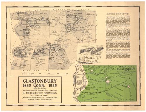
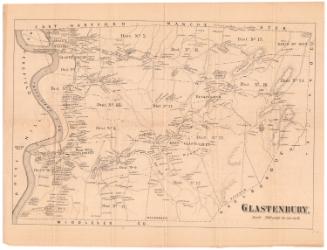
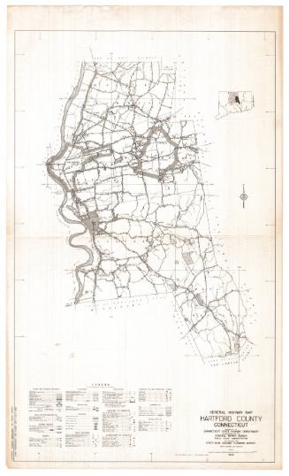
DescriptionReproduction of a map of Glastonbury, Connecticut, as it appeared in 1869, from the town lines of East Hartford and Manchester to the north, the Tolland County line to the east, the Middlesex County line to the south, and the Connecticut River to the west. It is divided into 18 numbered districts divided by broken solid lines. Roads are shown but are not labeled, and are lined with small black squares representing the locations of residences and businesses, labeled with the owner's name. Natural features depicted include elevation, conveyed through hachure marks, brooks, lakes and ponds.
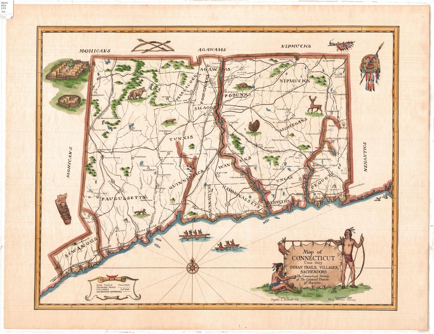
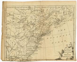
To the right is the "Indian Map of Glastonbury, 1600," created by the Indian Lore Committee and depicting the tribes present in what is now Glastonbury prior to white settlement. Between the two maps is a depiction of "Indian Fort at Red Hill," which shows two Native American dwellings and a fire surrounded on three sides by a fence, beside a body of water. Several paragraphs of text, titled, "Sketch of Indian History," recounts the early history of Native Americans in and around Glastonbury, from about 1600-1774.
To the right is the "Indian Map of Glastonbury, 1600," created by the Indian Lore Committee and depicting the tribes present in what is now Glastonbury prior to white settlement. Between the two maps is a depiction of "Indian Fort at Red Hill," which shows two Native American dwellings and a fire surrounded on three sides by a fence, beside a body of water. Several paragraphs of text, titled, "Sketch of Indian History," recounts the early history of Native Americans in and around Glastonbury, from about 1600-1774.
Label TextHartford, Windsor, and Wethersfield have always vied for the title of "Connecticut's oldest town;" Glastonbury has never been among the contenders. Its first settlers came from Wethersfield, on the opposite side of the Connecticut River. Wethersfield (at first known as Watertown) was settled in 1634 and can legitimately be considered the eariest permanent English town in Connecticut. Wethersfield proudly celebrated the three-hundredth anniversary of its founding in 1934. Glastonbury held its own Tercentenary celebration a year later, although Glastonbury did not exist as a separate town until 1692. The Connecticut State Tercentenary in 1936 marked the anniversary of the founding of Hartford byThomas Hooker and his party in 1636.
The Indian Map of Glastonbury was prepared by the Indian Lore Committee of the Glastonbury Tercentenary Committee under the direction of its chairman, Dr. Lee J. Whittles. The reproduction of the Baker & Tilden map of Glastonbury at the left of the sheet was presumably provided to help users of the Indian map orient themselves since only Indian and other early names appear on the Indian Map..
NotesCartographic Note: Scale, Glastonbury town map: 1 3/8 inches equals 1 mileThe Indian Map of Glastonbury was prepared by the Indian Lore Committee of the Glastonbury Tercentenary Committee under the direction of its chairman, Dr. Lee J. Whittles. The reproduction of the Baker & Tilden map of Glastonbury at the left of the sheet was presumably provided to help users of the Indian map orient themselves since only Indian and other early names appear on the Indian Map..
Status
Not on view

Object/Object