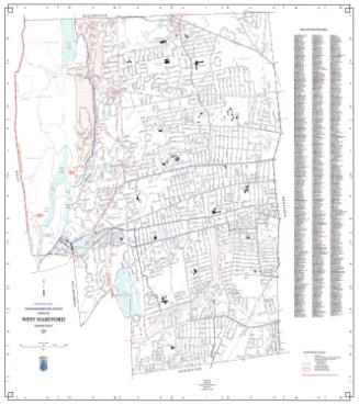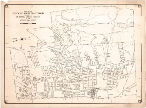
Map of the Town of West Hartford
PublisherPublished by
Metropolitan District Commission
(American, founded 1929)
Date1937
MediumLithography; black printer's ink on wove paper
DimensionsPrimary Dimensions (image heigth x width): 25 3/8 x 35in. (64.5 x 88.9cm)
Sheet (height x width): 27 5/8 x 37in. (70.2 x 94cm)
Sheet (height x width): 27 5/8 x 37in. (70.2 x 94cm)
ClassificationsGraphics
Credit LineGift of Mrs. E. S. Holland
DescriptionMap of West Hartford, oriented so that north points to the right side. The town is bordered by Bloomfield to the north, Hartford to the east, Newington to the south, and Farmington and Avon to the west. Local streets, cemeteries, schools, parks, ponds and reservoirs are depicted. The New York, New Haven and Hartford Railroad line is visible in the lower left corner.
Object number1977.120.1
NotesCartographic Note: Scale: 1 inch equals 1000 feetOn View
Not on view