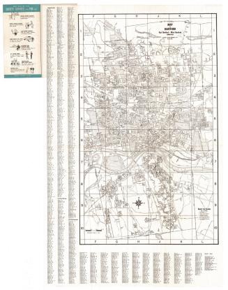
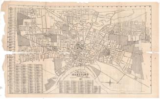
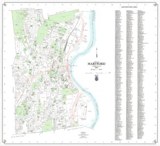
Map of City of Hartford
PrinterPrinted by
C. S. Axtell Company
(American, active from about 1910 - about 1959)
PublisherPublished by
Connecticut Valley Guide Co.
(American)
Date1931
MediumLithography; black printer's ink on wove paper
DimensionsPrimary Dimensions (image height x width): 18 1/2 x 19 1/8in. (47 x 48.6cm)
Sheet (height x width): 19 1/2 x 30in. (49.5 x 76.2cm)
ClassificationsGraphics
Credit LineGift of Martin A. Gilman
Object number2001.192.3
DescriptionPocket street maps of Hartford and West Hartford, Connecticut, and Springfield and East Springfield, Massachusetts. Schools, colleges and universities, parks, and hospitals are marked. The New York, New Haven and Hartford Railroad runs through both cities, and the Hartford map shows street-railroad lines. Street indexes and advertisements for local companies are also found next to both maps.
Label TextPrinted and published in Springfield, Massachusetts, this map depicts not only Springfield itself, but also Hartford, Connecticut. The two cities are both located on the Connnecticut River, a mere twenty-three miles apart, connected by both highway and railroad. Travelers in 1931 probably used both means of transportation to get back and forth between them. Cheaply printed on poor paper, the map is clearly a product of the Great Depression. Combining the two cities on a single map may have been a way for the publisher to increase his audience, assuring himself of a market in both cities.
NotesCartographic Note: Scale: 3 inches equals 1 mileStatus
Not on view