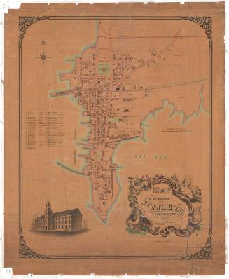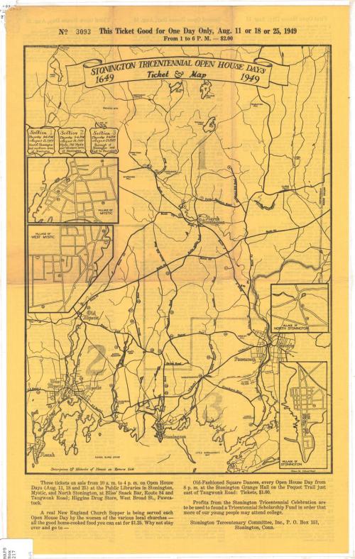

Stonington Tricentennial Open House Days, 1649-1949, Ticket and Map
DraftsmanDrawn by
C. Russell Neagle
(American, 1913 - 2006)
PublisherPublished by
Stonington Tercentenary Committee, Inc.
(American, founded 1949)
Date1949
MediumLithography; printed in black ink on wove paper
DimensionsPrimary Dimensions (image height x width): 15 x 10 3/4in. (38.1 x 27.3cm)
Sheet (height x width): 19 1/8 x 11 7/8in. (48.6 x 30.2cm)
Sheet (height x width): 19 1/8 x 11 7/8in. (48.6 x 30.2cm)
ClassificationsGraphics
Credit LineGift of Newton C. Brainard
DescriptionMap of the town of Stonington, Connecticut, with insets of Mystic, West Mystic, North Stonington and Stonington. The town is divided into three sections, each of which correspond to Open House Days on different dates. There are numbers inscribed within circles on the map that correspond to three lists on the verso announcing the private houses that were open to the public. Below the map is information about where the tickets were sold, as well as about additional tricentennial events and the scholarships funded by the profits.
Object number1950.554.1
NotesCartographic Note: No scaleOn View
Not on view