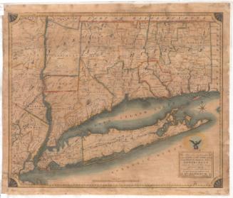
Connecticut
DraftsmanDrawn by
Fielding Lucas Jr.
(American, 1781 - 1854)
PrintmakerEngraved by
B. T. Welch
(American, active 1824)
PublisherPublished by
Fielding Lucas Jr.
(American, 1781 - 1854)
Date1824
MediumEngraving; black printer's ink and watercolor on wove paper
DimensionsPrimary Dimensions (image height x width): 9 3/8 x 11 3/4in. (23.8 x 29.8cm)
Platemark (height x width): 10 x 12 5/8in. (25.4 x 32.1cm)
Sheet (height x width): 11 5/8 x 15in. (29.5 x 38.1cm)
ClassificationsGraphics
Credit LineGift of William C. Conklin
Object number1971.71.10
DescriptionPolitcal and physical map of Connecticut with Massachusetts to the north, Rhode Island to the east, Long Island Sound and part of the coast of Long Island to the south, and New York to the east. Town and county boudaries are shown and counties are different colors. Major rivers and roads are indicated. Lines of small peaks are used to indicate hills and mountains. The title "CONNECTICUT" at lower right appears as if surrounded by clouds.
Label TextThis little 1824 map of Connecticut is apparently quite rare. Edmund Thompson had only seen one copy when he compiled his bibliography of Maps of Connecticut for the Years of the Industrial Revolution, 1801-1860. Fielding Lucas, Jr. was a productive mapmaker and publisher who for many years was active in Baltimore, Maryland. As was often the case with maps published outside the sate of Connecticut, Lucas's map is not very up to date and does not include the many new towns that had been incorporated during the 1810s and early 1820s.
NotesCartographic Note: 1 inch = 10 milesStatus
Not on view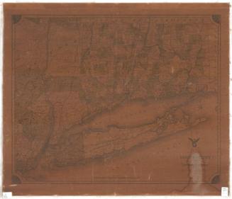


Lucius Stebbins & Co.
1859