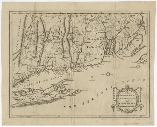
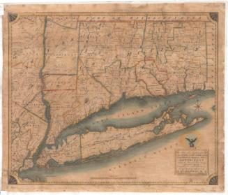
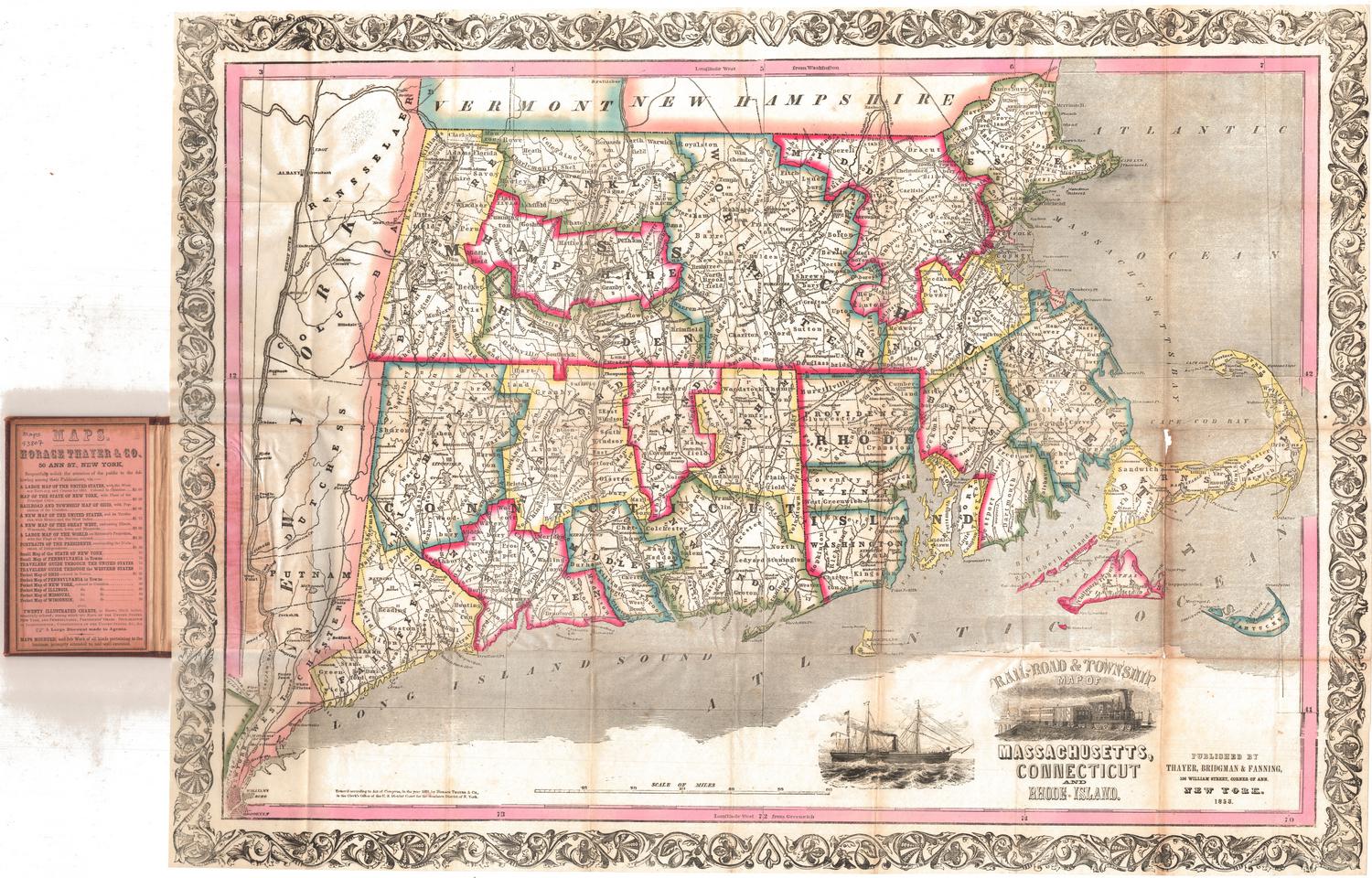
A New and Accurate Map of Connecticut and Rhode Island
DraftsmanDrawn by
Unknown
PublisherPublished by
Universal Magazine
(British, 1747 - 1814)
Date1780
MediumEngraving; printer's ink on wove paper
DimensionsPrimary Dimensions (image height x width): 10 1/4 x 13 3/8in. (26 x 34cm)
Platemark (height x width): 10 1/2 x 13 1/2in. (26.7 x 34.3cm)
Sheet (height x width): 12 x 14 5/8in. (30.5 x 37.1cm)
Platemark (height x width): 10 1/2 x 13 1/2in. (26.7 x 34.3cm)
Sheet (height x width): 12 x 14 5/8in. (30.5 x 37.1cm)
ClassificationsGraphics
Credit LineGift of William C. Conklin
DescriptionMap of Connecticut and Rhode Island with the New York border to the west, Massachusetts to the north, Cape Cod Bay to the east, and the Atlantic Ocean south of Long Island to the south. Towns, rivers, and roads are indicated. Mountains and hills are shown by rows of peaks. "Lands granted by New York to Connecticut" are labeled at the left. A four point compass rose appearswest of Block Island, which is identified as Block Rock Island. Many place names are misspelled. An elaborate cartouche with rococo decorations is at the lower right.
Object number1971.71.9
NotesCartographic Note: No scaleOn View
Not on view


Thayer, Bridgman & Fanning
1853