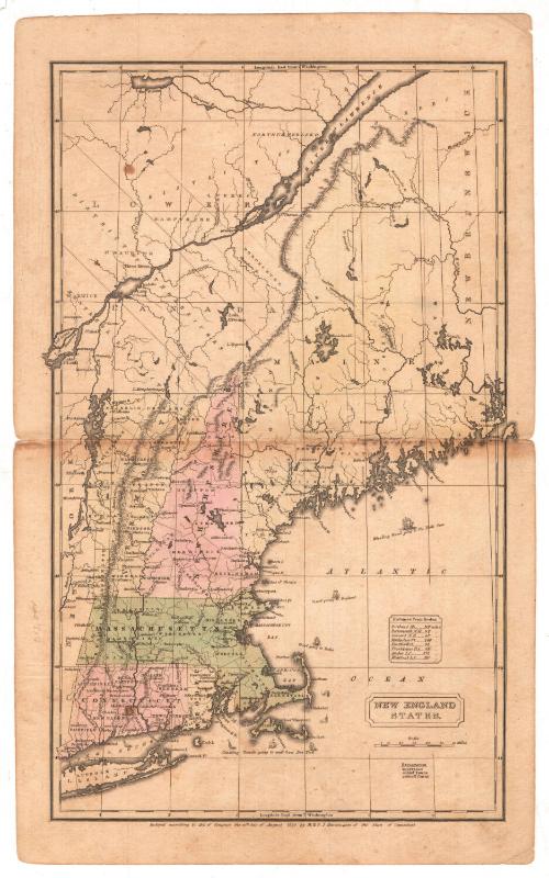
New England States
PublisherPublished by
H. & F. J. Huntington
(American, 1830 - 1832)
Date1830
MediumEngraving; printer's ink on wove paper
DimensionsPrimary Dimensions (image height x width): 16 x 9 5/8in. (40.6 x 24.4cm)
Sheet (height x width): 17 7/8 x 10 7/8in. (45.4 x 27.6cm)
Sheet (height x width): 17 7/8 x 10 7/8in. (45.4 x 27.6cm)
ClassificationsGraphics
Credit LineGift of William C. Conklin
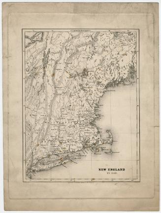
DescriptionMap of the New England states of Maine, New Hampshire, Vermont, Massachusetts, Connecticut, and Rhode Island from Lake Saint John and the Saint Lawrence River to the north; Passamaquoddy Bay to the east; the Atlantic Ocean south of Long Island to the south; and the eastern part of New York state to the west. Distances from Boston are indicated at the right. An explanation shows how CAPITALS, Chief Towns, and Small Towns are indicated on the map. Longitude is given east from Washington.
Object number1971.71.8
NotesCartographic Note: 1 5/8 inches = 60 milesOn View
Not on view


H. F. Sumner & Co.
1833