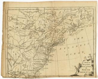
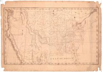
Map of the United States of America
MakerMade by
Amos Doolittle
(American, 1754 - 1832)
Date1790
MediumEngraving; black printer's ink on laid paper
DimensionsPrimary Dimensions (image height x width): 8 1/8 x 9 5/8in. (20.6 x 24.4cm)
Sheet (height x width): 8 1/2 x 10in. (21.6 x 25.4cm)
Sheet (height x width): 8 1/2 x 10in. (21.6 x 25.4cm)
ClassificationsGraphics
Credit LineGift of William C. Conklin
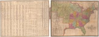
DescriptionMap of the United States as it appeared in 1790, from the Great Lakes and border with Canada to the north, the Atlantic Ocean to the east, Florida to the south, and Louisiana to the west. The states depicted are labeled, with dotted and broken solid lines representing boundaries. Population centers are marked with open circles and are labeled. Natural features include elevation, conveyed through clusters of peaks, and rivers and lakes, both of which are labeled.
Object number1971.71.6
NotesCartographic Note: No scaleOn View
Not on view